alb3274711
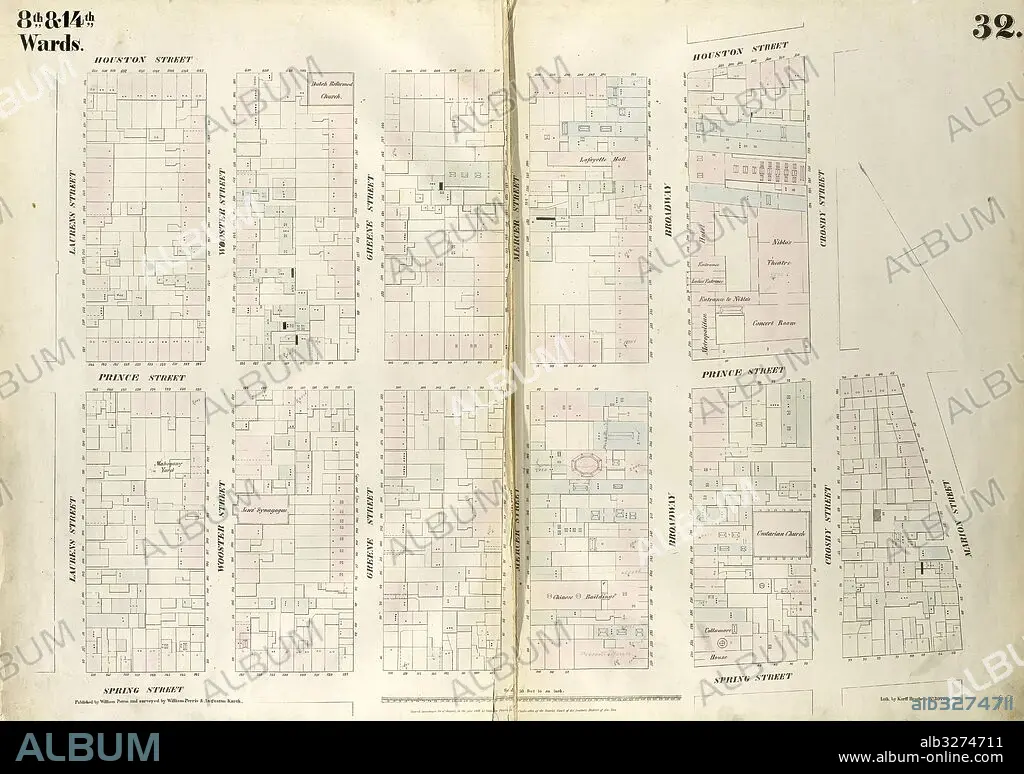
Plate 32: Map bounded by Houston Street, Crosby Street, Prince Street, Marion Street, Spring Street, Laurens Street. 1852, 1854, William Perris, New York, N.Y., USA.
| Share |
|---|
 Pinterest Pinterest |
 Twitter Twitter |
 Facebook Facebook |
 Copy link Copy link |
 Email Email |
|
Add to another lightbox |
|
Add to another lightbox |


Caption:
Plate 32: Map bounded by Houston Street, Crosby Street, Prince Street, Marion Street, Spring Street, Laurens Street. 1852, 1854, William Perris, New York, N.Y., USA
Credit:
Album / quintlox
Releases:
Model: No - Property: No
Rights questions?
Rights questions?
Image size:
6039 x 4254 px | 73.5 MB
Print size:
51.1 x 36.0 cm | 20.1 x 14.2 in (300 dpi)
Keywords:
1854 • AMERICA • AMERICAS • CARTOGRAPHIC • CARTOGRAPHY • CROSBY STREET • EEUU • GEOGRAPHY • HISTORIC MAP • HOUSTON STREET • LAURENS STREET 1852 • MANHATTAN, NEW YORK • MAP BOUNDED BY • MAP MAKING • MAP • MARION STREET • NEW YORK CITY • NEW YORK • NEW YORK, USA • NY • OLD MAP • PLAN (CARTOGRAPHY) • PLATE 32 • PRINCE STREET • SPRING STREET • UNITED STATES • VINTAGE MAP • WILLIAM PERRIS
