alb4613892
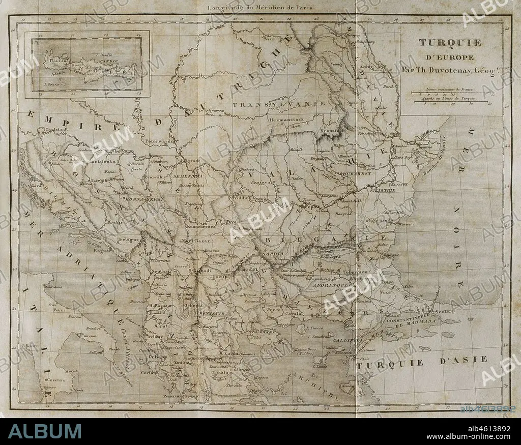
European Turkey map by Thunot Duvotenay. Historia de Turquia by Joseph Marie Jouannin (1783-1844) and Jules Van Gaver, 1840.
| Share |
|---|
 Pinterest Pinterest |
 Twitter Twitter |
 Facebook Facebook |
 Copy link Copy link |
 Email Email |
|
Add to another lightbox |
|
Add to another lightbox |


Caption:
European Turkey map by Thunot Duvotenay. Historia de Turquia by Joseph Marie Jouannin (1783-1844) and Jules Van Gaver, 1840.
Credit:
Album / Prisma
Releases:
Model: No - Property: No
Rights questions?
Rights questions?
Image size:
4370 x 3506 px | 43.8 MB
Print size:
37.0 x 29.7 cm | 14.6 x 11.7 in (300 dpi)
Keywords:
1840 • 19TH CENTURY • 19TH • ADRIATIC SEA • ADRIATIC • ALBANIA • ANCIENT • ANTIQUE • BALCANES • BALKAN • BALKANS • BLACK SEA • BOSNIA • BOSPHORUS STRAIT • BOSPHORUS • BOSPORUS • BULGARIA • CARTOGRAPHY • CONSTANTINOPLE • DOMAIN • DOMINATION • DUVOTENAY • ENGRAVED • ENGRAVING (ARTWORK) • ENGRAVING • ENGRAVING. • ENGRAVINGS • ETCHING • EUROPE • EUROPEA • EUROPEAN TURKEY • EUROPEAN • GREECE • HISTORIA UNIVERSAL • HISTORY OF TURKEY • HISTORY • MAP MAKING • MAP • MAPPING • MARMARA • MOLDAVIA • MOLDOVA • NARROW • OLD • OTTOMAN DOMINATION • OTTOMAN EMPIRE • OTTOMAN • OTTOMANS • PLAN (CARTOGRAPHY) • PRINT • ROMANIA • RUMANIA • STRAIT • TERRITORY • TRANSYLVANIA • TURK • TURKEY • TURKISH EMPIRE • TURKISH WAR • TURKISH • WALACHIA • WALLACHIA
