alb6092268
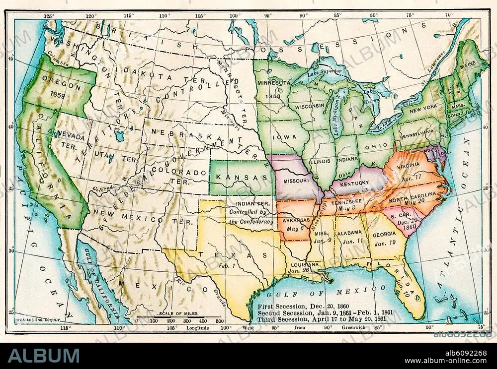
US map showing seceding states by date,
| Share |
|---|
 Pinterest Pinterest |
 Twitter Twitter |
 Facebook Facebook |
 Copy link Copy link |
 Email Email |
|
Add to another lightbox |
|
Add to another lightbox |


Title:
US map showing seceding states by date,
Caption:
See automatic translation
US map showing seceding states by date, American Civil War, 1860 and 1861. Printed color lithograph 19th century
Credit:
Album / akg/North Wind Picture Archives
Releases:
Model: No - Property: No
Rights questions?
Rights questions?
Image size:
3364 x 2326 px | 22.4 MB
Print size:
28.5 x 19.7 cm | 11.2 x 7.8 in (300 dpi)
Keywords:
19TH CENTURY • ART • ARTS • ARTWORK • CIVIL WAR • EE. UU. • ESTADOS UNIDOS USA EEUU EE. UU. EUA E. U. A. • HISTORIA UNIVERSAL • HISTORY • HUNDRED YEARS WAR • ILLUSTRATION • LEGEND • MAP • NORTH AMERICA • PHOTOGRAPH • PHOTOGRAPHY • PLAN (CARTOGRAPHY) • SOUTH • STORY USES • U. S. A. • U.S. • UNITED STATES OF AMERICA • UNITED STATES, THE • UNITES STATES OF AMERICA USA • USA • WAR • WORK OF ART
