alb1652926
Map of Palestine, engraving 1830
| Share |
|---|
 Pinterest Pinterest |
 Twitter Twitter |
 Facebook Facebook |
 Copy link Copy link |
 Email Email |
|
Add to another lightbox |
|
Add to another lightbox |


Title:
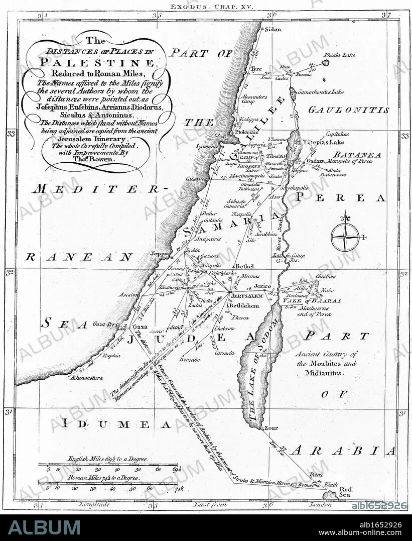
Map of Palestine, engraving 1830
Caption:
Map of Palestine showing distances in Roman miles. Based on various ancient authors and the " Jerusalem Itinerary". Engraving c1830
Credit:
Album / Universal Images Group / Universal History Archive
Releases:
Model: No - Property: No
Rights questions?
Rights questions?
Image size:
3929 x 4900 px | 55.1 MB
Print size:
33.3 x 41.5 cm | 13.1 x 16.3 in (300 dpi)
Keywords:
1830 • BIBLE OT • BIBLE • BIBLE; • BIBLIA • BIBLICAL • CHRISTIANISM • CHRISTIANITY • CRISTIANDAD • CRISTIANISMO • CULT, JEWISH • ENGRAVED • ENGRAVING (ARTWORK) • ENGRAVING • ENGRAVING. • ENGRAVINGS • ETCHING • FRAME • GEOGRAPHY • IDEAS • ILLUSTRATION • JERUSALEM ITINERARY • JEWISH RELIGION • JUDAISM • JUDAISMO • LETTERS • LITERATURA • LITERATURE • MAP • NO PEOPLE • OLD TESTAMENT • PALESTINAN • PALESTINE • PLAN (CARTOGRAPHY) • PRINT • RECREATION • RELIGION JUDIA • RELIGION • RELIGION: JEWISH • ROMAN MILES • THOUGHTS • VERTICAL LINES • VERTICAL • WESTERN SCRIPT • WITHOUT PEOPLE • WRITER
