alb4080465
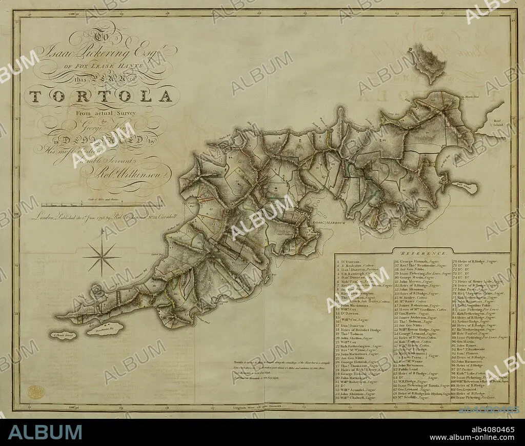
A plan of the Island of Tortola . A Plan of the Island of Tortola from actual Survey. Wilkinson, 1798. Source: Maps K.Top.123.72. Language: English.
| Share |
|---|
 Pinterest Pinterest |
 Twitter Twitter |
 Facebook Facebook |
 Copy link Copy link |
 Email Email |
|
Add to another lightbox |
|
Add to another lightbox |


Caption:
A plan of the Island of Tortola . A Plan of the Island of Tortola from actual Survey. Wilkinson, 1798. Source: Maps K.Top.123.72. Language: English.
Personalities:
Credit:
Album / British Library
Releases:
Model: No - Property: No
Rights questions?
Rights questions?
Image size:
7535 x 6012 px | 129.6 MB
Print size:
63.8 x 50.9 cm | 25.1 x 20.0 in (300 dpi)
Keywords:
18TH CENTURY • 18TH CENTURY, THE • ARCHIPELAGO • ARCHIVE • ARCHIVES • ATLANTIC OCEAN • ATLANTIC • CARIBBEAN SEA • CARIBBEAN • DOCUMENT • ISLAND • NO ONE • NO-ONE • NOBODY • OCEAN, ATLANTIC • PLAN
