alb1648613
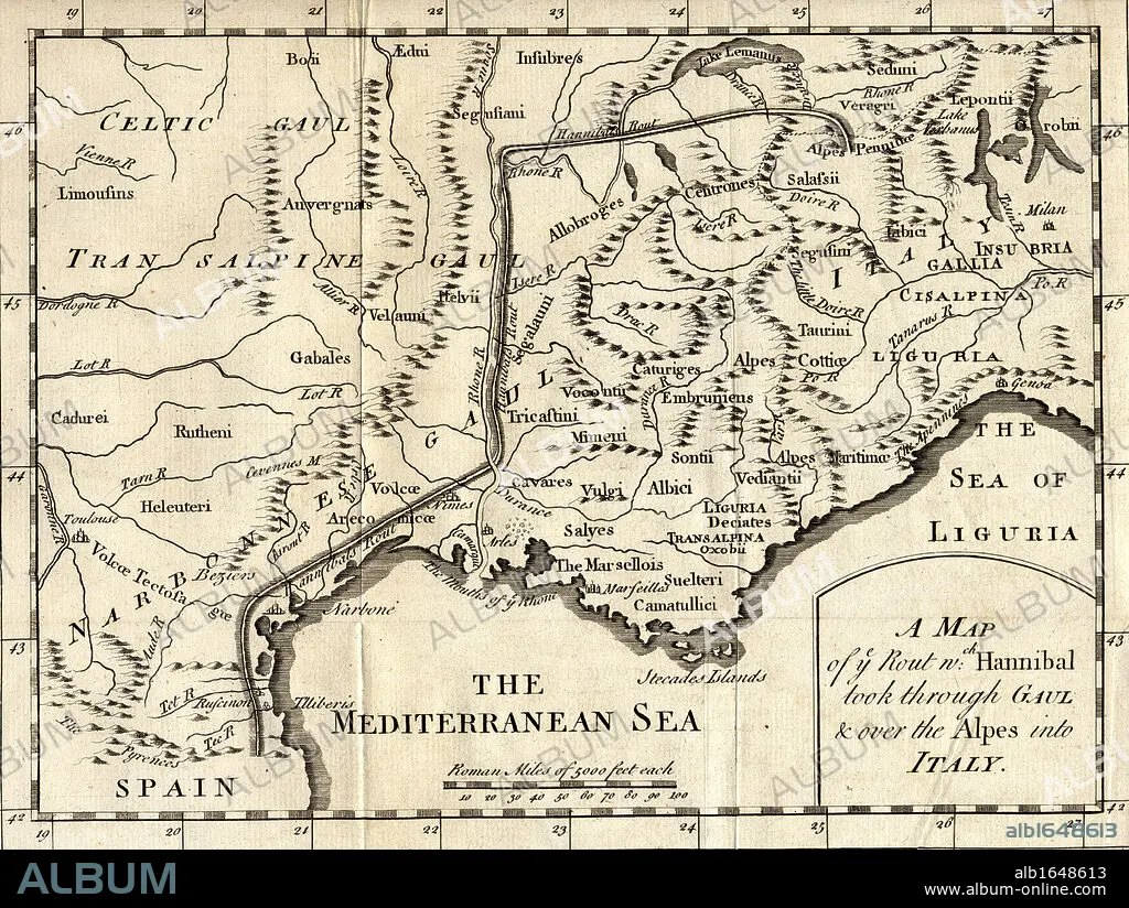
A map of the route Hannibal took through Gaul and over the Alps into Italy.
| Share |
|---|
 Pinterest Pinterest |
 Twitter Twitter |
 Facebook Facebook |
 Copy link Copy link |
 Email Email |
|
Add to another lightbox |
|
Add to another lightbox |


Caption:
A map of the route Hannibal took through Gaul and over the Alps into Italy
Credit:
Album / Universal Images Group / Universal History Archive
Releases:
Model: No - Property: No
Rights questions?
Rights questions?
Image size:
5298 x 3988 px | 60.4 MB
Print size:
44.9 x 33.8 cm | 17.7 x 13.3 in (300 dpi)
Keywords:
ALPS • BLACK & WHITE • BLACK AND WHITE • CARTOGRAPHY • GAUL • GEOGRAPHY • HANNIBAL • HORIZONTAL • ILLUSTRATION • ITALIA • ITALY • KEN • MAP MAKING • MAP • PLAN (CARTOGRAPHY) • ROUTE • WELSH
