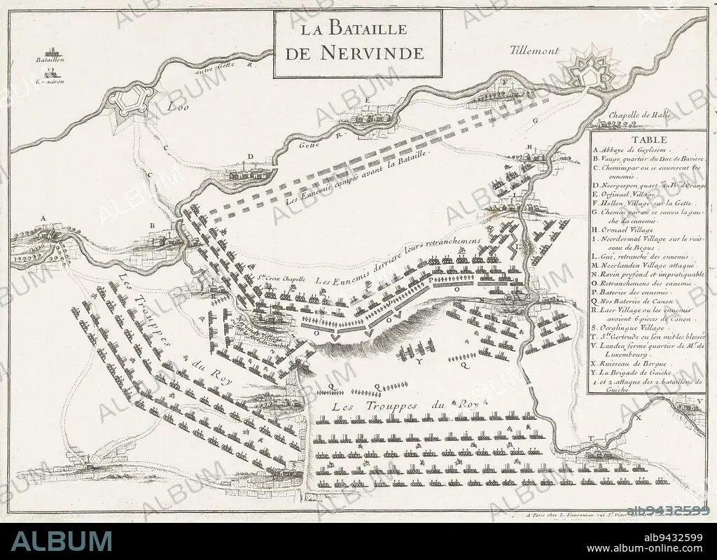
alb9432599
Map of the battle at Landen (Neerwinden) between the Allies under King William III and the French under the Duke of Luxembourg, 29 July 1693. On the right the legend A-Y in French. Map of the battle of Landen, 1693 La Bataille de Neervinde , print maker: anonymous, publisher: Louis Simonneau, (mentioned on object), print maker: France, publisher: Paris, 1693, paper, etching, h 241 mm × w 333 mm.
| Share |
|---|
 Pinterest Pinterest |
 Twitter Twitter |
 Facebook Facebook |
 Copy link Copy link |
 Email Email |
|
Add to another lightbox |
|
Add to another lightbox |


Caption:
Map of the battle at Landen (Neerwinden) between the Allies under King William III and the French under the Duke of Luxembourg, 29 July 1693. On the right the legend A-Y in French. Map of the battle of Landen, 1693 La Bataille de Neervinde , print maker: anonymous, publisher: Louis Simonneau, (mentioned on object), print maker: France, publisher: Paris, 1693, paper, etching, h 241 mm × w 333 mm
Credit:
Album / quintlox
Releases:
Model: No - Property: No
Rights questions?
Rights questions?
Image size:
4951 x 3612 px | 51.2 MB
Print size:
41.9 x 30.6 cm | 16.5 x 12.0 in (300 dpi)
Keywords:
1693 LA BATAILLE DE NEERVINDE • 1693 • 29 JULY 1693 • ALLIES UNDER KING WILLIAM III • ANONYMOUS • BATTLE • COMBAT • DISPUTE • DUKE • ETCHING • FIGHT • FIGHTING • FRANCE • FRENCH UNDER • FRENCH • H 241 MM × W 333 MM • LANDEN • LEGEND A-Y • LOUIS SIMONNEAU • LUXEMBOURG • MAP • MENTIONED • NEERWINDEN • OBJECT • OBJECTS • PAPER AND PACKAGE PRODUCTS • PAPER • PARIS • PLAN (CARTOGRAPHY) • PRINT MAKER • PUBLISHER • RIGHT • SCUFFLE • STRUGGLE • UMBRELLA
