alb5412836
US Map, James Polk,1848
| Share |
|---|
 Pinterest Pinterest |
 Twitter Twitter |
 Facebook Facebook |
 Copy link Copy link |
 Email Email |
|
Add to another lightbox |
|
Add to another lightbox |


Title:
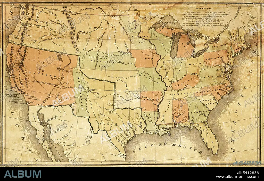
US Map, James Polk,1848
Caption:
This map was presented during US President James K. Polk's annual message to Congress in December 1848. It shows Polk's vision of how to divide up the new territory acquired through the Treaty of Guadalupe-Hidalgo, at the end of the Mexican-American War. Mexico ceded 55 percent of its territory, including parts of present-day Arizona, California, New Mexico, Texas, Colorado, Nevada, and Utah, to the United States.
Credit:
Album / Science Source / National Archives
Releases:
Model: No - Property: No
Rights questions?
Rights questions?
Image size:
3840 x 2433 px | 26.7 MB
Print size:
32.5 x 20.6 cm | 12.8 x 8.1 in (300 dpi)
Keywords:
1840S • 1848 • 19TH CENTURY • ACQUISITION • AMERICA • BORDER • CALIFORNIA • EXPANSION • HISTORY • ILLUSTRATION • JAMES POLK • MAP • MEXICAN-AMERICAN WAR • MEXICO • MISSOURI COMPROMISE • NEW MEXICO • POLITICS • PRESIDENT JAMES POLK • STATES • TERRITORIAL • TERRITORY • TEXAS • TREATY OF GUADALUPE-HIDALGO • USA • WESTWARD EXPANSION
