alb3548564
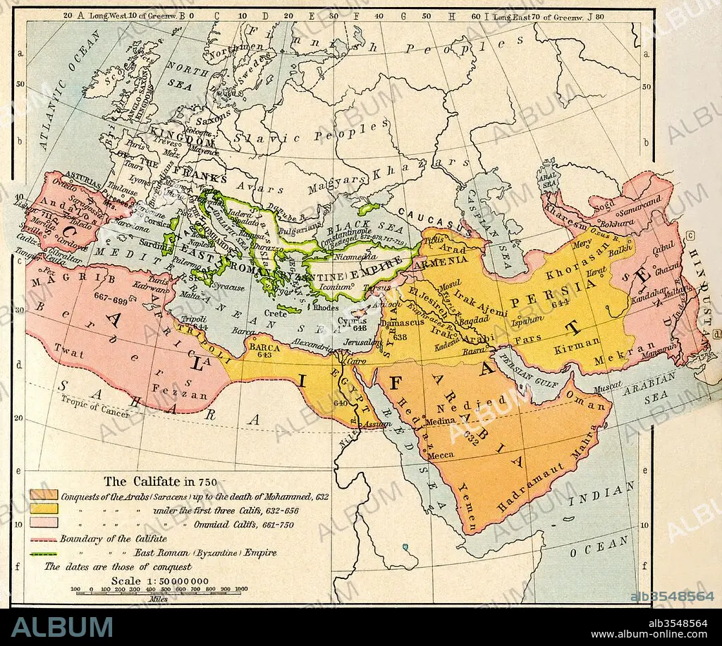
Map of the Muslim expansion and the Byzantine Empire at the end of the Umayyad Caliphate, in 750
| Share |
|---|
 Pinterest Pinterest |
 Twitter Twitter |
 Facebook Facebook |
 Copy link Copy link |
 Email Email |
|
Add to another lightbox |
|
Add to another lightbox |


Title:
Map of the Muslim expansion and the Byzantine Empire at the end of the Umayyad Caliphate, in 750
Caption:
Map of the Muslim expansion and the Byzantine Empire at the end of the Umayyad Caliphate, in 750. From Historical Atlas, published 1923.
Credit:
Album / Universal Images Group / Universal History Archive
Releases:
Model: No - Property: No
Rights questions?
Rights questions?
Image size:
4724 x 3982 px | 53.8 MB
Print size:
40.0 x 33.7 cm | 15.7 x 13.3 in (300 dpi)
Keywords:
750 • 8TH CENTURY • BYZANTINE • CALIFATE • CALIPHATE • CENTURY • CHART • COUNTRIES • COUNTRY • EIGHTH CENTURY • EIGHTH • EMPIRE • END • EXPANSION • GEOGRAPHICAL • GEOGRAPHY • HISTORIA UNIVERSAL • HISTORICAL • HISTORY • MAP • MUSLIM • PLAN (CARTOGRAPHY) • UMAYYAD
