alb4314029
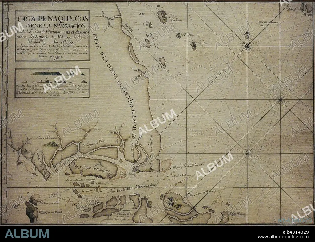
Chart of the Singapore Strait, 1778. It is a representation of Singapore with the name of "Island and Kingdom of Sincapura", as an independent realm prior to British colonisation. It includes an elevation plan of Viola Island, identified as "Island of Vandurria", the earliest known depiction of this land in a Spanish document. Naval Museum. Madrid. Spain.
| Share |
|---|
 Pinterest Pinterest |
 Twitter Twitter |
 Facebook Facebook |
 Copy link Copy link |
 Email Email |
|
Add to another lightbox |
|
Add to another lightbox |


Caption:
Chart of the Singapore Strait, 1778. It is a representation of Singapore with the name of "Island and Kingdom of Sincapura", as an independent realm prior to British colonisation. It includes an elevation plan of Viola Island, identified as "Island of Vandurria", the earliest known depiction of this land in a Spanish document. Naval Museum. Madrid. Spain.
Credit:
Album / Prisma
Releases:
Model: No - Property: No
Rights questions?
Rights questions?
Image size:
4016 x 2874 px | 33.0 MB
Print size:
34.0 x 24.3 cm | 13.4 x 9.6 in (300 dpi)
Keywords:
1778 • 18TH CENTURY • 18TH CENTURY, THE • 18TH • ARCHIPELAGO • ASIA • ASIAN • ASIATIC • ASIATICA • CARTOGRAPHY • CHART • COAST • COASTAL • COASTLINE • COMMUNITY OF MADRID • COMPASS CARD • COMPASS ROSE • FAR EAST • FLEET • GEOGRAPHY • HISTORIA UNIVERSAL • HISTORY • ISLAND • LETTER • LITORAL • MADRID CITY • MADRID • MALAY KINGDOM • MAP MAKING • MAP • MARINE • MARITIME NAVIGATION • MARITIME • MODERN AGE • MODERN ERA • MODERN PERIOD • MUSEUM • MUSEUMS • NARROW • NAVAL MUSEUM • NAVEGATION • NAVIGATION • NAVY • OCEAN • PLAN (CARTOGRAPHY) • SAILING • SEA • SEASHORE • SEASIDE • SHIPPING • SHORELINE • SPAIN • SPANISH • STRAIT • WIND ROSE
