alb5528982
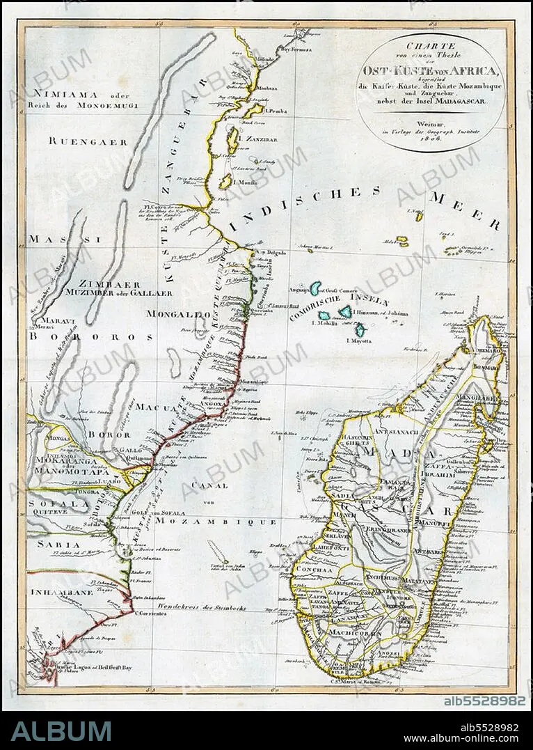
East Africa / Indian Ocean: Map of East Africa with Mozambique, Zanzibar and Madagascar. Weimar Geographische Institut,1806.
| Share |
|---|
 Pinterest Pinterest |
 Twitter Twitter |
 Facebook Facebook |
 Copy link Copy link |
 Email Email |
|
Add to another lightbox |
|
Add to another lightbox |


Title:
East Africa / Indian Ocean: Map of East Africa with Mozambique, Zanzibar and Madagascar. Weimar Geographische Institut,1806.
Caption:
The Swahili Coast refers to the coast or coastal area of East Africa inhabited by the Swahili people, mainly Kenya, Tanzania, and north Mozambique. The term may also include the islands such as Zanzibar, Pate or Comoros which lie off the Swahili Coast. The Swahili Coast has a distinct culture, religion and geography.
Credit:
Album / Pictures from History/Universal Images Group
Releases:
Model: No - Property: No
Rights questions?
Rights questions?
Image size:
3600 x 4814 px | 49.6 MB
Print size:
30.5 x 40.8 cm | 12.0 x 16.0 in (300 dpi)
Keywords:
AFRICA • AFRICAN • ARABIAN SEA • BAGAMOYO • CARTOGRAPHY • CHART • HISTORIA UNIVERSAL • HISTORICAL IMAGES • HISTORICAL PICTURES • HISTORICAL • HISTORY IMAGES • HISTORY PICTURES • HISTORY • INDIAN OCEAN • ISLAM • ISLAMISM • MAP MAKING • MAP • MOMBASA • MUSLIM WORLD • MUSLIM • PEMBA • PLAN (CARTOGRAPHY) • RELIGION • SOMALIA • STONE TOWN • STONETOWN • SUAHELI • SWAHILI COAST • SWAHILI • TANZANIA • TANZANIAN • ZANJ • ZANZIBAR • ZANZIBARI
