alb2114117
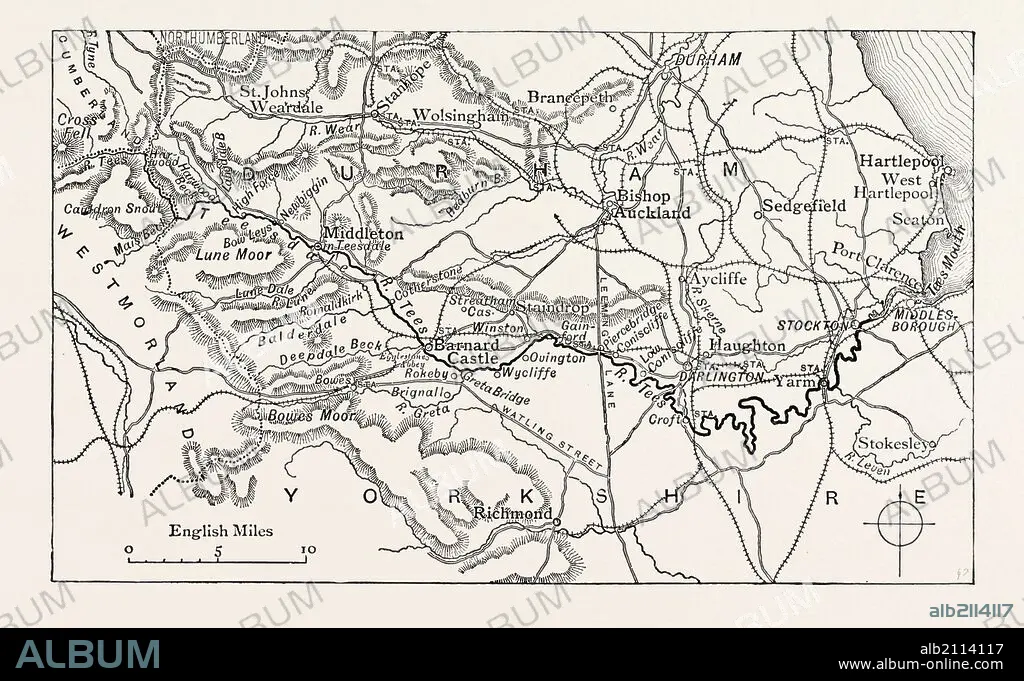
MAP OF THE COURSE OF THE TEES. The River Tees is in northern England. It rises on the eastern slope of Cross Fell in the North Pennines, and flows eastwards for 85 miles (137 km) to reach the North Sea between Hartlepool and Redcar near Middlesbrough. UK.
| Share |
|---|
 Pinterest Pinterest |
 Twitter Twitter |
 Facebook Facebook |
 Copy link Copy link |
 Email Email |
|
Add to another lightbox |
|
Add to another lightbox |


Caption:
MAP OF THE COURSE OF THE TEES. The River Tees is in northern England. It rises on the eastern slope of Cross Fell in the North Pennines, and flows eastwards for 85 miles (137 km) to reach the North Sea between Hartlepool and Redcar near Middlesbrough. UK
Credit:
Album / quintlox
Releases:
Model: No - Property: No
Rights questions?
Rights questions?
Image size:
3789 x 2322 px | 25.2 MB
Print size:
32.1 x 19.7 cm | 12.6 x 7.7 in (300 dpi)
Keywords:
137 • 19TH CENTURY ENGRAVING • 19TH CENTURY STYLE • 19TH CENTURY • 19TH • 85 • ARKHEIA • ARRIVE • ARTS • COURSE • CROSS FELL • CULTURE • EASTERN • EASTWARDS • ENGRAVED IMAGE • ENGRAVEMENT • FLOWS • GREAT BRITAIN • HARTLEPOOL • HISTORIA UNIVERSAL • HISTORY • ILLUSTRATIVE TECHNIQUE • KM • MAP • MIDDLESBROUGH • MILES • NORTH PENNINES • NORTH SEA • NORTHERN • PLAN (CARTOGRAPHY) • REACH • REDCAR • RETRO STYLED • RETRO • RISES • RIVER TEES • SLOPE • TEES • UK • VICTORIAN ERA • VICTORIAN • VINTAGE
