alb5909319
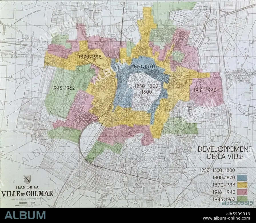
Colmar, City map, 1250-1962
| Share |
|---|
 Pinterest Pinterest |
 Twitter Twitter |
 Facebook Facebook |
 Copy link Copy link |
 Email Email |
|
Add to another lightbox |
|
Add to another lightbox |


Title:
Colmar, City map, 1250-1962
Caption:
Colmar (Alsace, Dép. Haut-Rhin, France). "Developpement de la ville" (Map of the development of the city from 1250/1300 to 1962.). Colour print.
Credit:
Album / akg-images / CDA / Guillemot
Releases:
Model: No - Property: No
Rights questions?
Rights questions?
Image size:
4961 x 4029 px | 57.2 MB
Print size:
42.0 x 34.1 cm | 16.5 x 13.4 in (300 dpi)
