alb9055670
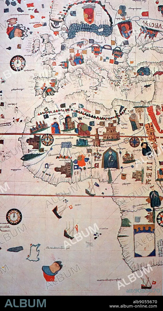
16th Century map depicting Africa and the Mediterranean Basin by Juan de la Cosa
| Share |
|---|
 Pinterest Pinterest |
 Twitter Twitter |
 Facebook Facebook |
 Copy link Copy link |
 Email Email |
|
Add to another lightbox |
|
Add to another lightbox |


Title:
16th Century map depicting Africa and the Mediterranean Basin by Juan de la Cosa
Caption:
16th Century map depicting Africa and the Mediterranean Basin by Juan de la Cosa. Juan de la Cosa (1450-1510) a Spanish navigator and cartographer, known for designing the earliest European world map that incorporated the territories of the Americas that were discovered during the 15th Century. Dated 15th Century
Credit:
Album / World History Archive
Releases:
Model: No - Property: No
Rights questions?
Rights questions?
Image size:
3402 x 6165 px | 60.0 MB
Print size:
28.8 x 52.2 cm | 11.3 x 20.6 in (300 dpi)
Keywords:
15TH CENTURY • AFRICA • AFRICAN CONTINENT • AFRICAN • BASIN • CARTOGRAPHER • CARTOGRAPHY • CHRISTOPHER COLUMBUS • EUROPE • EUROPEA • EUROPEAN WORLD MAP • EUROPEAN • GEOGRAPHY • GLOBE • HISTORY OF MAPS • JUAN DE LA COSA • JUAN THE BISCAYAN • MAP MAKING • MAP OF THE WORLD • MAP • MEDITERRANEAN BASIN • MEDITERRANEAN • NAVIGATOR • SPAIN • SPANISH • WORLD MAP • WORLD
