alb6147933
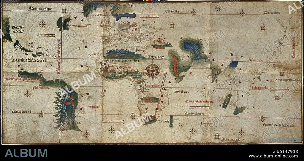
ALBERTO CANTINO. PLANISFERIO DE 1502 - LA COSTA DE AMERICA APARECE POR PRIMERA VEZ - LINEA DE DEMARCACION DEL TRATADO DE TORDESILLAS (IZQUIERDA)
| Share |
|---|
 Pinterest Pinterest |
 Twitter Twitter |
 Facebook Facebook |
 Copy link Copy link |
 Email Email |
|
Add to another lightbox |
|
Add to another lightbox |


Author:
Title:
PLANISFERIO DE 1502 - LA COSTA DE AMERICA APARECE POR PRIMERA VEZ - LINEA DE DEMARCACION DEL TRATADO DE TORDESILLAS (IZQUIERDA)
Caption:
The Cantino planisphere. It's the ealiest map where one can see for the very first time the American coasts.. Modena, Estense library. Italy
Location:
Credit:
Album / Oronoz
Releases:
Model: No - Property: No
Rights questions?
Rights questions?
Image size:
6349 x 3038 px | 55.2 MB
Print size:
53.8 x 25.7 cm | 21.2 x 10.1 in (300 dpi)
Keywords:
16 16TH XVI XVITH SIXTEENTH CENTURY • 16 CENTURY • 16TH CENTURY • 16TH • AFRICA • AFRICAN CONTINENT • AFRICAN • AMERICA • AMERICAS • BIBLIOTECA ESTENSE • CANTINO PLANISPHERE • CANTINO • CARTOGRAPHY • COLOR BLACK • ITALIA • ITALY • LATIN AMERICA • LATIN AMERICAN • LATINOAMERICA • MAP MAKING • MAP OF THE WORLD • MAP • MODENA • PLAN (CARTOGRAPHY) • PLANISPHERE • PORTOLANO • TREATY OF TORDESILLAS JUNE 7, 1494 • WORLD MAP
