alb3840178
Earthquake Zones Map
| Share |
|---|
 Pinterest Pinterest |
 Twitter Twitter |
 Facebook Facebook |
 Copy link Copy link |
 Email Email |
|
Add to another lightbox |
|
Add to another lightbox |


Title:
Earthquake Zones Map
Caption:
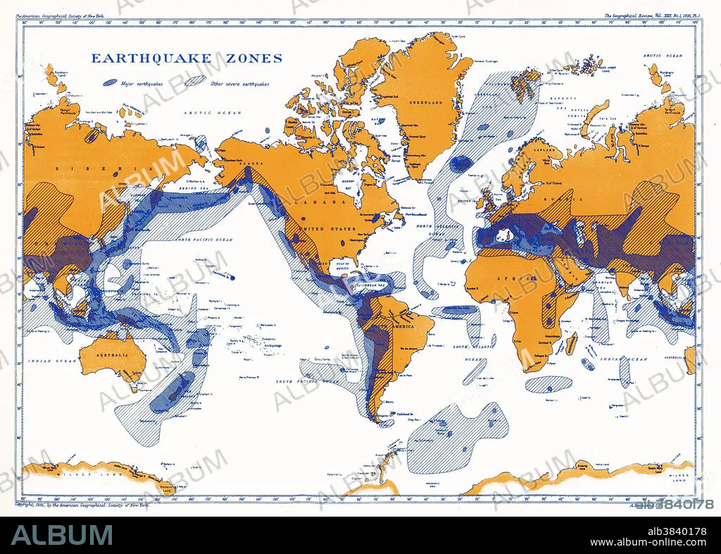
A map showing earthquake zones. This world seismicity map clearly shows the correlation of the Pacific Ring of Fire with earthquake epicentres, the Alpine-Himalayan Belt, and the coincidence of major portions of the mid-ocean ridge system with areas of seismicity.
Credit:
Album / Science Source / National Oceanic and Atmospheric Administration
Releases:
Model: No - Property: No
Rights questions?
Rights questions?
Image size:
5140 x 3680 px | 54.1 MB
Print size:
43.5 x 31.2 cm | 17.1 x 12.3 in (300 dpi)
Keywords:
ACTIVITY • ALPINE • ALPINE-HIMALAYAN • AREAS • ART • ARTWORK • BELT • CONTINENT • EARTH • EARTHQUAKE • EARTHQUAKES • EPICENTRES • FIRE • FLEET • GEOLOGY • GLOBAL • GRAPHIC • HIMALAYAN • HOTSPOTS • ILLUSTRATION • INFOGRAPHIC • MAP • MARINE • MARKED • MID-OCEAN • MOST • NAVY • NO ONE • NO-ONE • NOBODY • OCEAN • OF • OUTLINE • PACIFIC • RIDGE • RING • SEA • SEISM • SEISMIC • SEISMICITY • SEISMOLOGY • VOLCANOLOGY • WORLD • ZONE
