alb3982592
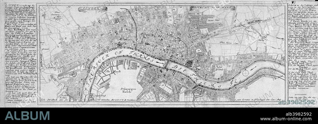
Map of London, 1700. Artist: Augustae Vindelicorum
| Share |
|---|
 Pinterest Pinterest |
 Twitter Twitter |
 Facebook Facebook |
 Copy link Copy link |
 Email Email |
|
Add to another lightbox |
|
Add to another lightbox |


Title:
Map of London, 1700. Artist: Augustae Vindelicorum
Caption:
Map of London, 1700. The City of London, City of Westminster, River Thames, Lambeth, Southwark and surrounding areas; either side contains text in German.
Credit:
Album / The London Archives (City of London)/Heritage Images
Releases:
Model: No - Property: No
Rights questions?
Rights questions?
Image size:
4306 x 1460 px | 18.0 MB
Print size:
36.5 x 12.4 cm | 14.4 x 4.9 in (300 dpi)
Keywords:
18TH CENTURY • 18TH CENTURY, THE • 18TH • AUGUSTAE VINDELICORUM • AUGUSTAE • BLACK & WHITE • BLACK AND WHITE • BRITAIN • BRITISH • CARTOGRAPHY • CENTURY • CITY OF LONDON • CITY OF WESTMINSTER • COUNTRY • EIGHTEENTH CENTURY • ENGLAND • ENGLISH • ENGRAVING • GEOGRAPHICAL FEATURE • GEOGRAPHY • GUILDHALL LIBRARY & ART GALLERY • JOHN STRIDBECK; STRIDBECK • JOHN • LAMBETH • LOCATION • LONDON • MAP MAKING • MAP • MAP-MAKING • MONOCHROMATIC • MONOCHROME • RIVER THAMES • RIVER • SOUTHWARK • THAMES • VINDELICORUM • WESTMINSTER
