alb4614689
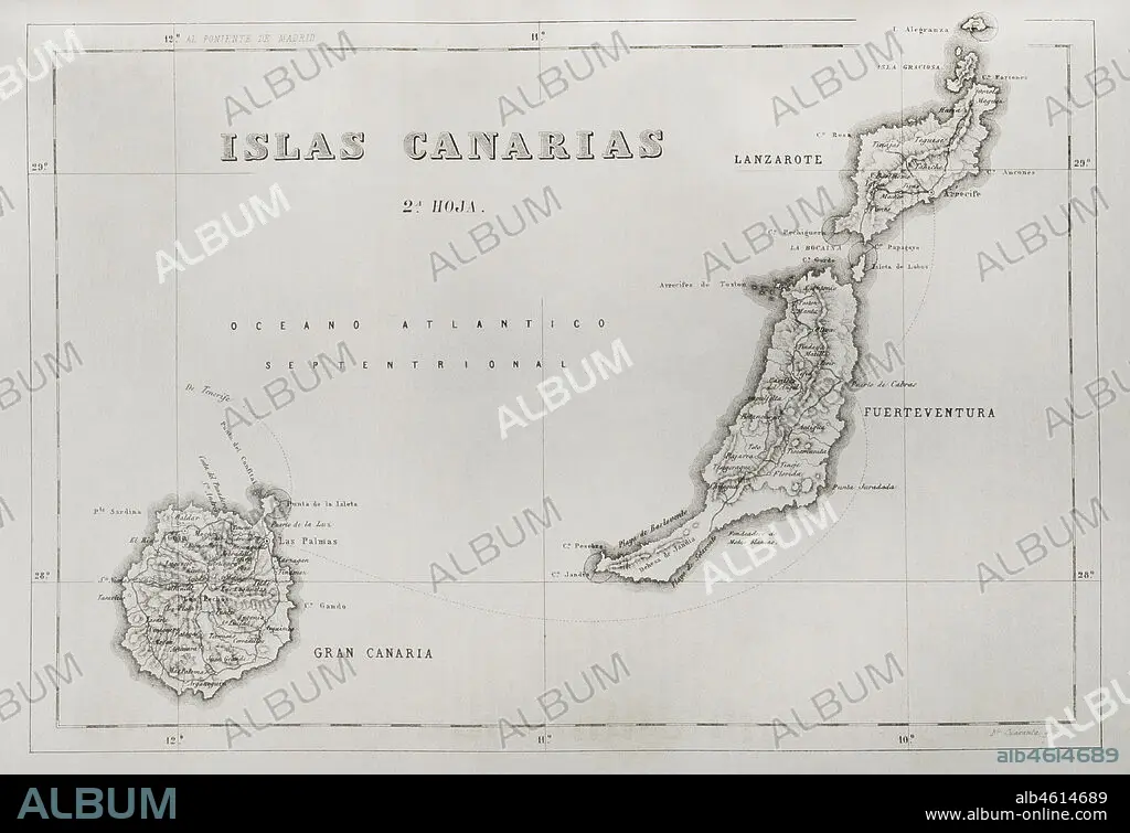
History of Spain. Map of the Canary Islands. Islands of Gran Canaria, Lanzarote and Fuerteventura. Engraving. Crónica General de España, Historia Ilustrada y Descriptiva de sus Provincias (General Chronicle of Spain, Illustrated and Descriptive History of its Provinces), Canaries, 1871.
| Share |
|---|
 Pinterest Pinterest |
 Twitter Twitter |
 Facebook Facebook |
 Copy link Copy link |
 Email Email |
|
Add to another lightbox |
|
Add to another lightbox |


Caption:
History of Spain. Map of the Canary Islands. Islands of Gran Canaria, Lanzarote and Fuerteventura. Engraving. Crónica General de España, Historia Ilustrada y Descriptiva de sus Provincias (General Chronicle of Spain, Illustrated and Descriptive History of its Provinces), Canaries, 1871.
Location:
PRIVATE COLLECTION
Credit:
Album / Prisma
Releases:
Model: No - Property: No
Rights questions?
Rights questions?
Image size:
4613 x 3164 px | 41.8 MB
Print size:
39.1 x 26.8 cm | 15.4 x 10.5 in (300 dpi)
Keywords:
1871 • 19TH CENTURY • 19TH • ALEGRANZA ISLAND • ALEGRANZA • ANCIENT CARTOGRAPHY • ANCIENT MAP • ARCHIPELAGO • ATLANTIC OCEAN • ATLANTIC • ATLÂNTICA • CANARIES • CANARY ISLANDS • CARTOGRAPHY • CHINIJO ARCHIPELAGO • CHINIJO • ENGRAVED • ENGRAVING (ARTWORK) • ENGRAVING • ENGRAVING. • ENGRAVINGS • ETCHING • FUERTEVENTURA • GEOGRAPHY • GRACIOSA ISLAND • GRACIOSA • GRACIOUS • GRAN CANARIA • GRAND CANARY ISLAND • HISTORIA UNIVERSAL • HISTORY • ISLAND • ISLANDS • ISLET • LA GRACIOSA • LANZAROTE • LAS PALMAS DE GRAN CANARIA • LAS PALMAS • LOBOS ISLAND • LOBOS • MAP KEY • MAP LEGEND • MAP MAKING • MAP • MAPPING • MAPS • OCEAN, ATLANTIC • OLD MAP • PALMAS, THE • PALMS, • PLAN (CARTOGRAPHY) • PRINT • PRIVATE COLLECTION • PROVINCE • PROVINCES • REEF • SPAIN • SPANISH • TERRITORIAL • TERRITORY • WOLVES • XIX
