alb3808408
Tabula Peutingeriana, Roman Empire Road Map
| Share |
|---|
 Pinterest Pinterest |
 Twitter Twitter |
 Facebook Facebook |
 Copy link Copy link |
 Email Email |
|
Add to another lightbox |
|
Add to another lightbox |


Title:
Tabula Peutingeriana, Roman Empire Road Map
Caption:
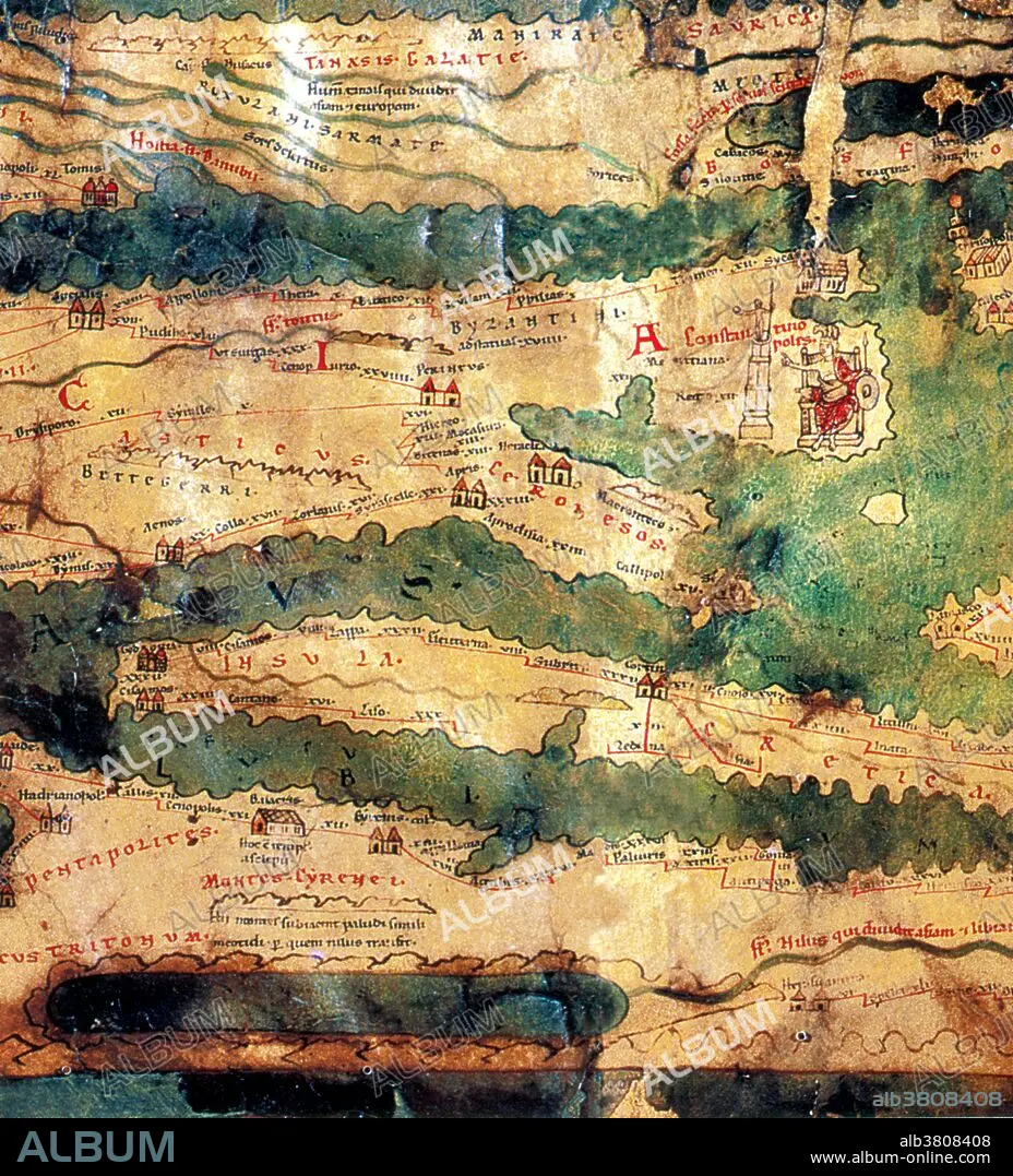
Detail of the Tabula Peutingeriana, an illustrated itinerarium (road map) showing the cursus publicus, the road network in the Roman Empire. The original map upon which it is based probably dates to the 4th or 5th century and was itself based on a map prepared by Agrippa during the reign of the emperor Augustus (27 BC - 14 AD) prepared under the direction of Marcus Vipsanius Agrippa, a friend of Augustus. After Agrippa's death, the map was engraved on marble and placed in the Porticus Vipsaniae, not far from the Ara Pacis. NOTE: with the distortion the course of the Nile is shown as parallel to the Mediterranean coast.
Credit:
Album / Science Source / New York Public Library
Releases:
Model: No - Property: No
Rights questions?
Rights questions?
Image size:
3614 x 3990 px | 41.3 MB
Print size:
30.6 x 33.8 cm | 12.0 x 13.3 in (300 dpi)
Keywords:
1ST BCE • 1ST CENTURY B. C. • 1ST CENTURY BC • 1ST CENTURY • 1ST ENTRY AD • AGRIPPA • ANCIENT CIVILIZATION • ANCIENT CULTURE • ANCIENT • ARCHAEOLOGICAL • ARCHAEOLOGY • ARCHEOLOGICAL • ART • ARTWORK • CARTOGRAPHY • CURSUS PUBLICUS • DRAWING • GEOGRAPHY • HISTORIC • HISTORICAL • HISTORY • ILLUSTRATION • ITINERARIUM • MAP MAKING • MAP • MARCUS AGRIPPA • MARCUS VIPSANIUS AGRIPPA • PEUTINGER MAP • PEUTINGER TABLE • ROAD MAP • ROAD NETWORK • ROMAN EMPIRE • ROMAN • TABULA PEUTINGERIANA
