alb9871596
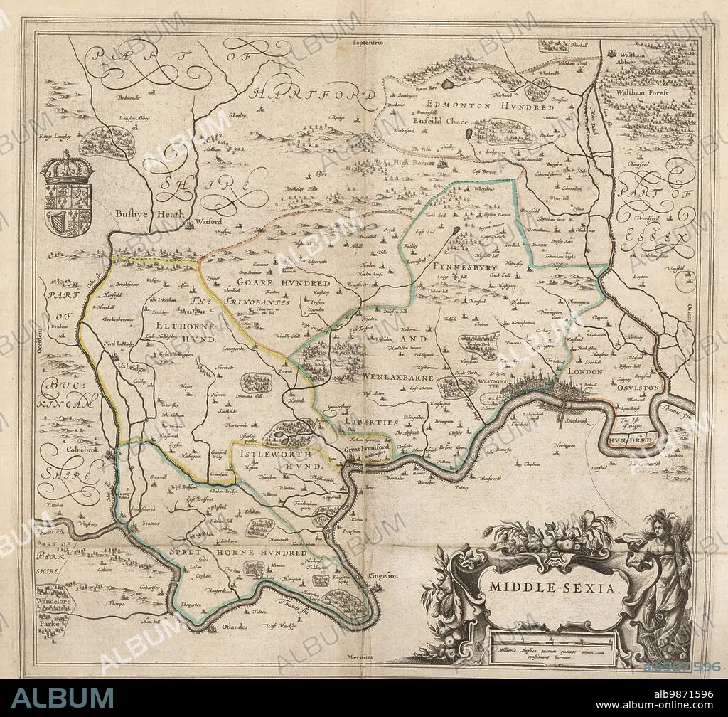
Map of the city of London and county of Middlesex, circa 1600. London shown as clutch of churches, surrounded by parishes Kensington, Chelsey, St. Gylles, Lambeth, Southwork, Hampton Court, on the River Thames, Hyde Park and Marybon Park. With title Middle-Sexia in cartouche and coat of arms. Handcoloured copperplate engraving by Johannes Blaeu from Geographiae Volumen Quintum quo Angliae, county atlas of England and Wales, Amsterdam, 1662.
| Share |
|---|
 Pinterest Pinterest |
 Twitter Twitter |
 Facebook Facebook |
 Copy link Copy link |
 Email Email |
|
Add to another lightbox |
|
Add to another lightbox |


Caption:
Map of the city of London and county of Middlesex, circa 1600. London shown as clutch of churches, surrounded by parishes Kensington, Chelsey, St. Gylles, Lambeth, Southwork, Hampton Court, on the River Thames, Hyde Park and Marybon Park. With title Middle-Sexia in cartouche and coat of arms. Handcoloured copperplate engraving by Johannes Blaeu from Geographiae Volumen Quintum quo Angliae, county atlas of England and Wales, Amsterdam, 1662.
Personalities:
Credit:
Album / Florilegius
Releases:
Model: No - Property: No
Rights questions?
Rights questions?
Image size:
5081 x 4740 px | 68.9 MB
Print size:
43.0 x 40.1 cm | 16.9 x 15.8 in (300 dpi)
Keywords:
1662 • AMSTERDAM • CARTOUCHE • CHART • CHELSEY • CHURCH • CIRCA 1600 • CITY OF LONDON • CITY • COAT OF ARMS • COPPERPLATE ENGRAVING • COUNTY ATLAS • COUNTY • DUTCH • ECCLESIA • GEOGRAPHIAE VOLUMEN QUINTUM QUO ANGLIAE • GEOGRAPHY • HAMPTON COURT (GB) • HAMPTON COURT • HANDCOLOURED • HISTORIA UNIVERSAL • HISTORY • HYDE PARK • JOHANNES BLAEU • KENSINGTON • LAMBETH • LONDON • MAP • MAPMAKER • MARYBON PARK • MIDDLE-SEXIA • MIDDLESEX • NETHERLANDISH • PARISH • PLAN (CARTOGRAPHY) • PLAN • PUEBLO • RIVER THAMES • SOUTHWORK • ST. GYLLES • THAMES • TITLE • TOPOGRAPHY • TOWN • VILLAGE • WESTMINSTER
