alb4291876
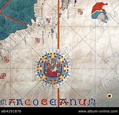
Copy of Juan de La Cosa's map (detail)
| Share |
|---|
 Pinterest Pinterest |
 Twitter Twitter |
 Facebook Facebook |
 Copy link Copy link |
 Email Email |
|
Add to another lightbox |
|
Add to another lightbox |


Title:
Copy of Juan de La Cosa's map (detail)
Caption:
Nautical chart. Detail of the islands of Cuba and Santo Domingo (La Espagnola). Copy of the map of Juan de La Cosa (1450-1510) drawn in 1500. Genoa, Galata Museum of the Sea (Galata Museo del Mare)
Credit:
Album / Alfredo Dagli Orti/Photo12
Releases:
Model: No - Property: No
Rights questions?
Rights questions?
Image size:
4600 x 4169 px | 54.9 MB
Print size:
38.9 x 35.3 cm | 15.3 x 13.9 in (300 dpi)
Keywords:
16 16TH XVI XVITH SIXTEENTH CENTURY • 16 CENTURY • 16TH CENTURY • 16TH • CARTOGRAPHY • COMPASS CARD • COMPASS ROSE • CONQUEROR • CONQUISTADOR • DISCOVERER • DISCOVERY • EXPLORATION • EXPLORER • GEOGRAPHY • MAP MAKING • NAUTICAL MAP • PASSENGER • PORTOLAN CHART • RESEARCHER (MALE) • RESEARCHER • SPAIN • SPANISH • TRAVELER • TRAVELLER • TRAVELLERS • VIRGIN WITH CHILD • VOYAGER • WIND ROSE
