alb4094254
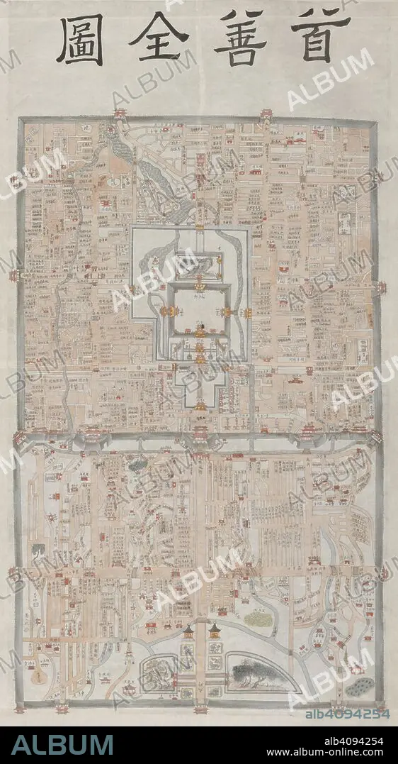
Peking. c.1800. This manuscript map of Peking appears to be based on a detailed survey carried out during the 18th century under the Ch'ing emperor Ch'ien-lung (r.1736-1796). The Imperial palace (the Forbidden City), is shown in the centre of the inner city. Originally published/produced in c.1800. . Source: Add. 22048,. Language: Chinese.
| Share |
|---|
 Pinterest Pinterest |
 Twitter Twitter |
 Facebook Facebook |
 Copy link Copy link |
 Email Email |
|
Add to another lightbox |
|
Add to another lightbox |


Caption:
Peking. c.1800. This manuscript map of Peking appears to be based on a detailed survey carried out during the 18th century under the Ch'ing emperor Ch'ien-lung (r.1736-1796). The Imperial palace (the Forbidden City), is shown in the centre of the inner city. Originally published/produced in c.1800. . Source: Add. 22048,. Language: Chinese.
Credit:
Album / British Library
Releases:
Model: No - Property: No
Rights questions?
Rights questions?
Image size:
5376 x 9791 px | 150.6 MB
Print size:
45.5 x 82.9 cm | 17.9 x 32.6 in (300 dpi)
Keywords:
ARTS • ASIA • BEIJING • CARTOGRAPHY • CHINA • CHINE • CHINESE • CITY • CROSSING • CROSSROAD • DISCIPLINE • EAST ASIA • FAIRWAY • FORBIDDEN • HIGHWAY • HUMANITIES • INFRASTRUCTURE • INTERSECTION • JUNCTION • MAP MAKING • MAP • MOTORWAY • PEKING • PLAN (CARTOGRAPHY) • PORCELAIN • PROHIBITED • PROHIBITION • ROAD • ROADS • RUA • SETTLEMENT • SETTLEMENTS • STREET • STREETS • TRANSPORTATION INFRASTRUCTURE • VIA • VISUAL ARTS • WAY
