alb11646216
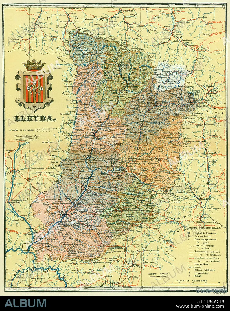
España. Catalunya. Mapa físico de la provincia de Lleyda y sus comarcas. Años 1930.
| Share |
|---|
 Pinterest Pinterest |
 Twitter Twitter |
 Facebook Facebook |
 Copy link Copy link |
 Email Email |
|
Add to another lightbox |
|
Add to another lightbox |


Caption:
See automatic translation
España. Catalunya. Mapa físico de la provincia de Lleyda y sus comarcas. Años 1930
Credit:
Album / Documenta
Releases:
Model: No - Property: No
Rights questions?
Rights questions?
Image size:
3944 x 5079 px | 57.3 MB
Print size:
33.4 x 43.0 cm | 13.1 x 16.9 in (300 dpi)
Keywords:
20TH CENTURY • CATALONIA • COMARCA • COUNTRY ROAD • GEOGRAPHY • LERIDA • LLEIDA • MAP • MAPS • MOUNT • MOUNTAIN • MOUNTAINS • MOUNTAINS. • OROGRAPHY • PATH • PLAN (CARTOGRAPHY) • PROVINCE OF LLEIDA • REGION • RIVER • ROAD • ROUTE • SPAIN • WAY
