alb4062591
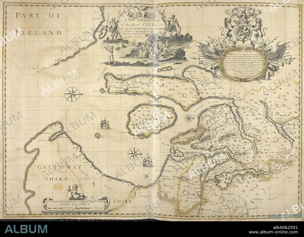
A New and Exact Map Of the River Clyde. A New and Exact Map Of the River CLYDE / Done by the late Mr John Adair Hidrographer and Fellow of the Royal Society and now Publish'd for the Good of the Publick by Geo: Scott. Glasgow, 1731. 1 map : copperplate engraving with hand colour ; 48 x 68 cm; Scale approximately 1:253,440. Source: Maps K.Top 48/76.
| Compartir |
|---|
 Pinterest Pinterest |
 Twitter Twitter |
 Facebook Facebook |
 Copiar enlace Copiar enlace |
 Email Email |
|
Añadir a otro lightbox |
|
Añadir a otro lightbox |


¿Ya tienes cuenta? Iniciar sesión
¿No tienes cuenta? Regístrate
Compra esta imagen

Autor:
Descripción:
Ver traducción automática
A New and Exact Map Of the River Clyde. A New and Exact Map Of the River CLYDE / Done by the late Mr John Adair Hidrographer and Fellow of the Royal Society and now Publish'd for the Good of the Publick by Geo: Scott. Glasgow, 1731. 1 map : copperplate engraving with hand colour ; 48 x 68 cm; Scale approximately 1:253,440. Source: Maps K.Top 48/76.
Crédito:
Album / British Library
Autorizaciones:
Modelo: No - Propiedad: No
¿Preguntas relacionadas con los derechos?
¿Preguntas relacionadas con los derechos?
Tamaño imagen:
6253 x 4553 px | 81.5 MB
Tamaño impresión:
52.9 x 38.5 cm | 20.8 x 15.2 in (300 dpi)
Palabras clave:
ADAIR, JOHN • ALBION • CARTOGRAFIA • CARTOGRAFICO • ESCOCIA • EUROPA OCCIDENTAL • EUROPA • GRAN BRETAÑA • INGLATERRA • IRLANDA • ISLAS BRITANICAS • MAPA
