alb1655975
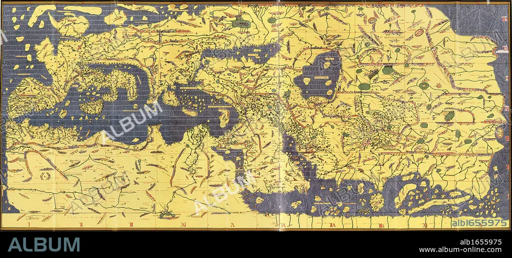
The 'Kitab Rudjdjar' or 'Tabula Rogeriana', an early world map the work of the Arab geographer Muhammad al-Idrisi (1100-1165) in 1154 for Roger II (1095-1154) King of Sicily from 1130. In this map, North is at the bottom.
| Compartir |
|---|
 Pinterest Pinterest |
 Twitter Twitter |
 Facebook Facebook |
 Copiar enlace Copiar enlace |
 Email Email |
|
Añadir a otro lightbox |
|
Añadir a otro lightbox |


¿Ya tienes cuenta? Iniciar sesión
¿No tienes cuenta? Regístrate
Compra esta imagen

Descripción:
Ver traducción automática
The 'Kitab Rudjdjar' or 'Tabula Rogeriana', an early world map the work of the Arab geographer Muhammad al-Idrisi (1100-1165) in 1154 for Roger II (1095-1154) King of Sicily from 1130. In this map, North is at the bottom.
Crédito:
Album / Universal History Archive/Universal Images Group
Autorizaciones:
Modelo: No - Propiedad: No
¿Preguntas relacionadas con los derechos?
¿Preguntas relacionadas con los derechos?
Tamaño imagen:
6284 x 2850 px | 51.2 MB
Tamaño impresión:
53.2 x 24.1 cm | 20.9 x 9.5 in (300 dpi)
