alb5410241
Transcontinental Railroad Map,1877
| Compartir |
|---|
 Pinterest Pinterest |
 Twitter Twitter |
 Facebook Facebook |
 Copiar enlace Copiar enlace |
 Email Email |
|
Añadir a otro lightbox |
|
Añadir a otro lightbox |


¿Ya tienes cuenta? Iniciar sesión
¿No tienes cuenta? Regístrate
Compra esta imagen

Título:
Transcontinental Railroad Map,1877
Descripción:
Ver traducción automática
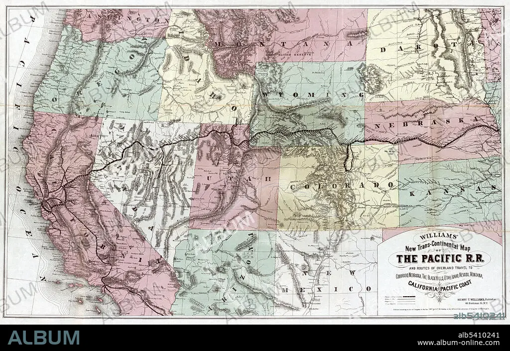
Transcontinental map of the Pacific Railroad and routes of overland travel to Colorado, Nebraska, the Black Hills, Utah, Idaho, Nevada, Montana, California and the Pacific Coast. Union Pacific Railroad Company, 1877. The First Transcontinental Railroad (known originally as the "Pacific Railroad" and later as the "Overland Route") was a 1,912-mile continuous railroad line constructed between 1863 and 1869 that connected the existing eastern U.S. rail network at Council Bluffs, Iowa with the Pacific coast at the Oakland Long Wharf on San Francisco Bay. The rail line was built by three private companies over public lands provided by extensive US land grants. It opened for through traffic between Sacramento and Omaha on May 10, 1869, when CPRR President Leland Stanford ceremonially tapped the gold "Last Spike" (later often referred to as the "Golden Spike") with a silver hammer at Promontory Summit.
Crédito:
Album / Science Source / LOC
Autorizaciones:
Modelo: No - Propiedad: No
¿Preguntas relacionadas con los derechos?
¿Preguntas relacionadas con los derechos?
Tamaño imagen:
5933 x 3776 px | 64.1 MB
Tamaño impresión:
50.2 x 32.0 cm | 19.8 x 12.6 in (300 dpi)
Palabras clave:
1869 • 1877 • AMÉRICA DEL NORTE • AMERICA • CONSTRUCCION • ESTADOS UNIDOS DE AMERICA • FERROCARRIL • HISTORIA • MAPA • NORTEAMERICA • SIGLO XIX • TRANSPORTE
