alb9439364
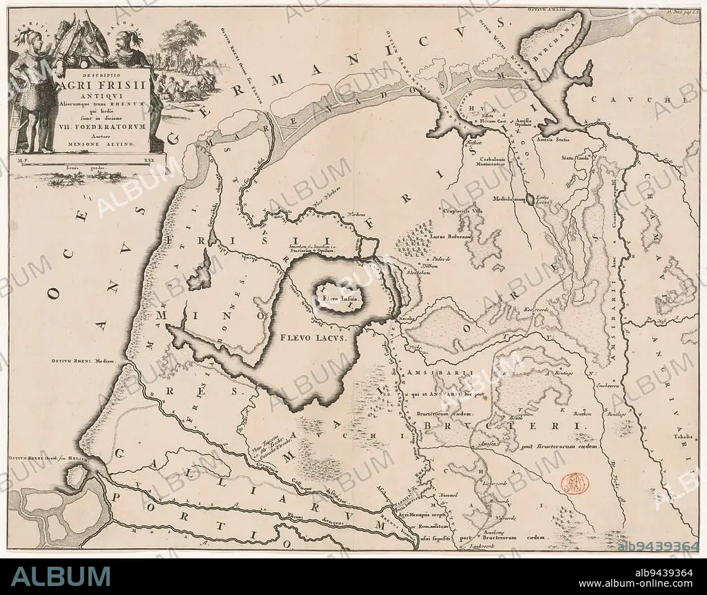
Historical map of the Netherlands with the areas of the Batavians and Frisians, Descriptio agri Frisii Antiqui (...) (title on object), Map of the Frisian areas in Roman times. Top left cartouche with title, surrounded by arms and Frisian chieftains Verritus and Malorix, depicted in the background warriors. Scale stick below cartouche: Semis gradus., print maker: Jan Luyken, Menso Alting, (mentioned on object), Netherlands, 1697 - 1700 and/or 1725, paper, engraving, etching, height 329 mm × width 420 mm.
| Compartir |
|---|
 Pinterest Pinterest |
 Twitter Twitter |
 Facebook Facebook |
 Copiar enlace Copiar enlace |
 Email Email |
|
Añadir a otro lightbox |
|
Añadir a otro lightbox |


¿Ya tienes cuenta? Iniciar sesión
¿No tienes cuenta? Regístrate
Compra esta imagen

Descripción:
Ver traducción automática
Historical map of the Netherlands with the areas of the Batavians and Frisians, Descriptio agri Frisii Antiqui (...) (title on object), Map of the Frisian areas in Roman times. Top left cartouche with title, surrounded by arms and Frisian chieftains Verritus and Malorix, depicted in the background warriors. Scale stick below cartouche: Semis gradus., print maker: Jan Luyken, Menso Alting, (mentioned on object), Netherlands, 1697 - 1700 and/or 1725, paper, engraving, etching, height 329 mm × width 420 mm
Crédito:
Album / quintlox
Autorizaciones:
Modelo: No - Propiedad: No
¿Preguntas relacionadas con los derechos?
¿Preguntas relacionadas con los derechos?
Tamaño imagen:
3636 x 2871 px | 29.9 MB
Tamaño impresión:
30.8 x 24.3 cm | 12.1 x 9.6 in (300 dpi)
Palabras clave:
1697 • AGUAFUERTE • ENGRAVING • GRABADO • GRABADOS • JAN LUYKEN • MAPA HISTORICO • MAPA • OBJETO • PAISES BAJOS • PAPEL • RODEADO • ZONAS
