alb5411336
Roanoke Colony Map,1585
| Compartir |
|---|
 Pinterest Pinterest |
 Twitter Twitter |
 Facebook Facebook |
 Copiar enlace Copiar enlace |
 Email Email |
|
Añadir a otro lightbox |
|
Añadir a otro lightbox |


¿Ya tienes cuenta? Iniciar sesión
¿No tienes cuenta? Regístrate
Compra esta imagen

Título:
Roanoke Colony Map,1585
Descripción:
Ver traducción automática
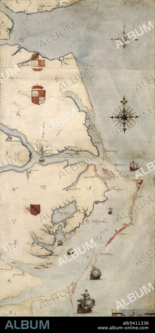
John White's map of the Roanoke Colony area, c. 1585. The first colony on Roanoke Island was established by governor Ralph Lane in 1585. Following the failure of the 1585 settlement, a second colony led by John White landed on the same island in 1587, and became known as the Lost Colony due to the unexplained disappearance of its population.
Crédito:
Album / Science Source
Autorizaciones:
Modelo: No - Propiedad: No
¿Preguntas relacionadas con los derechos?
¿Preguntas relacionadas con los derechos?
Tamaño imagen:
1800 x 3675 px | 18.9 MB
Tamaño impresión:
15.2 x 31.1 cm | 6.0 x 12.2 in (300 dpi)
Palabras clave:
1585 • ACAMPAR • AMÉRICA DEL NORTE • AMERICA • ARTE • ASENTAMIENTO • BRITANICO • CAMPAMENTO • CAROLINA DEL NORTE • COLONIA (TERRITORIO) • COLONIALISMO • COLONO • ESTADOS UNIDOS DE AMERICA • FORTALEZA • GRABADO • HISTORIA • ILUSTRACION • INGLES • MAPA • NORTEAMERICA • PERDIDA COLONIAS • PRIMERO • S. XVI • SIGLO XVI • VIRGINIA
