alb3958118
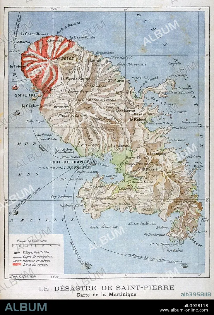
Map showing the eruption of Mount Pelee, Martinique, 1902. Artist: Unknown
| Compartir |
|---|
 Pinterest Pinterest |
 Twitter Twitter |
 Facebook Facebook |
 Copiar enlace Copiar enlace |
 Email Email |
|
Añadir a otro lightbox |
|
Añadir a otro lightbox |


¿Ya tienes cuenta? Iniciar sesión
¿No tienes cuenta? Regístrate
Compra esta imagen

Título:
Map showing the eruption of Mount Pelee, Martinique, 1902. Artist: Unknown
Descripción:
Ver traducción automática
Map showing the eruption of Mount Pelee, Martinique, 1902. The catastrophic eruption of Mount Pelee on Martinique in 1902 was the worst volcanic disaster of the 20th century. The eruption created a pyroclastic flow which caused between 26,000 to 36,000 casualties and destroyed the city of Saint-Pierre. An illustration from Le Petit Journal, 25th May 1902.
Crédito:
Album / Artmedia / Heritage Images
Autorizaciones:
Modelo: No - Propiedad: No
¿Preguntas relacionadas con los derechos?
¿Preguntas relacionadas con los derechos?
Tamaño imagen:
3533 x 4947 px | 50.0 MB
Tamaño impresión:
29.9 x 41.9 cm | 11.8 x 16.5 in (300 dpi)
Palabras clave:
90S • AÑOS NOVENTA • CARIBE • COLOR • CONCEPTO • DECADA NOVENTA • DESASTRE NATURAL • DESASTRE • FRANCES • FRANCIA • GEOGRAFIA • INDIAS OCCIDENTALES • ISLA • MAPA • MAR • MARTINICA • PAÍS • SIGLO XX • SIGLO • VOLCAN
