alb2012977
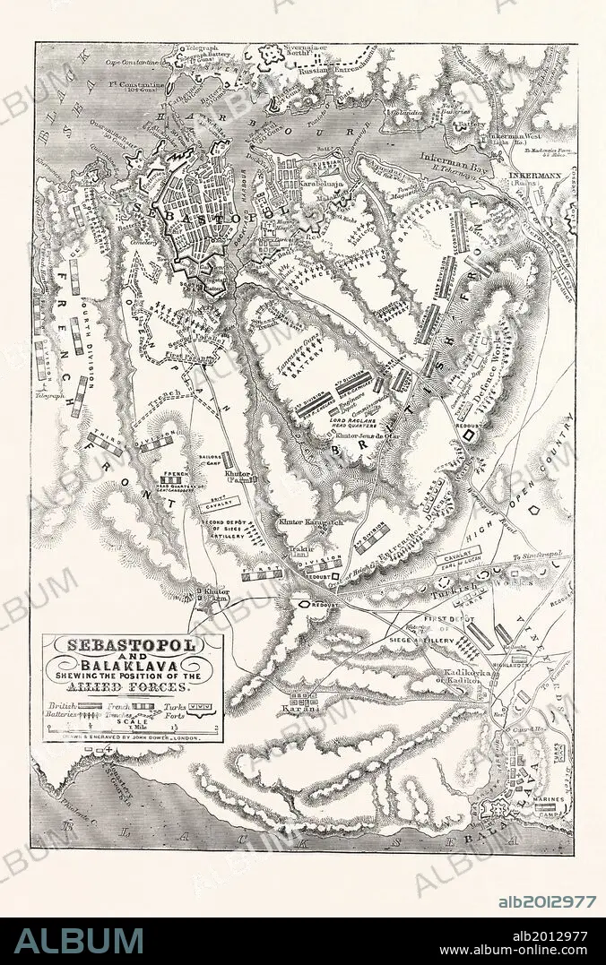
THE CRIMEAN WAR: MAP OF SEBASTOPOL AND BALAKLAVA, SHOWING THE POSITION OF THE ALLIED FORCES, 1854.
| Compartir |
|---|
 Pinterest Pinterest |
 Twitter Twitter |
 Facebook Facebook |
 Copiar enlace Copiar enlace |
 Email Email |
|
Añadir a otro lightbox |
|
Añadir a otro lightbox |


¿Ya tienes cuenta? Iniciar sesión
¿No tienes cuenta? Regístrate
Compra esta imagen

Descripción:
Ver traducción automática
THE CRIMEAN WAR: MAP OF SEBASTOPOL AND BALAKLAVA, SHOWING THE POSITION OF THE ALLIED FORCES, 1854
Crédito:
Album / quintlox
Autorizaciones:
Modelo: No - Propiedad: No
¿Preguntas relacionadas con los derechos?
¿Preguntas relacionadas con los derechos?
Tamaño imagen:
4446 x 6739 px | 85.7 MB
Tamaño impresión:
37.6 x 57.1 cm | 14.8 x 22.5 in (300 dpi)
Palabras clave:
