alb4062015
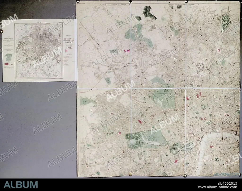
Map of London. Stanford's Library Map of London and its suburbs. London : E. Stanford, 1886. Stanford's Library Map of London and its suburbs. Image taken from Stanford's Library Map of London and its suburbs. Scale, 6 inches to 1 Eng. statute mile, or 1 : 10,560. Originally published/produced in London : E. Stanford, 1886. . Source: Maps.3480.(260), sheet 1. Language: English.
| Compartir |
|---|
 Pinterest Pinterest |
 Twitter Twitter |
 Facebook Facebook |
 Copiar enlace Copiar enlace |
 Email Email |
|
Añadir a otro lightbox |
|
Añadir a otro lightbox |


¿Ya tienes cuenta? Iniciar sesión
¿No tienes cuenta? Regístrate
Compra esta imagen

Descripción:
Ver traducción automática
Map of London. Stanford's Library Map of London and its suburbs. London : E. Stanford, 1886. Stanford's Library Map of London and its suburbs. Image taken from Stanford's Library Map of London and its suburbs. Scale, 6 inches to 1 Eng. statute mile, or 1 : 10,560. Originally published/produced in London : E. Stanford, 1886. . Source: Maps.3480.(260), sheet 1. Language: English.
Crédito:
Album / British Library
Autorizaciones:
Modelo: No - Propiedad: No
¿Preguntas relacionadas con los derechos?
¿Preguntas relacionadas con los derechos?
Tamaño imagen:
5808 x 4293 px | 71.3 MB
Tamaño impresión:
49.2 x 36.3 cm | 19.4 x 14.3 in (300 dpi)
Palabras clave:
ALBION • BARCO-PRISION • BIBLIOTECA • CALABOZO • CARCEL • CARTOGRAFIA • EDIFICIO GUBERNAMENTAL • EDIFICIO OFICIAL • EUROPA OCCIDENTAL • EUROPA • GRAN BRETAÑA • HULK • INGLATERRA • ISLAS BRITANICAS • LONDON • LONDRES • MAPA • PRISION • SERPENTINA • SUBURB • SUBURBANO • SUBURBIO
