alb5407151
Portolan Chart, Eastern Mediterranean,1590s
| Compartir |
|---|
 Pinterest Pinterest |
 Twitter Twitter |
 Facebook Facebook |
 Copiar enlace Copiar enlace |
 Email Email |
|
Añadir a otro lightbox |
|
Añadir a otro lightbox |


¿Ya tienes cuenta? Iniciar sesión
¿No tienes cuenta? Regístrate
Compra esta imagen

Título:
Portolan Chart, Eastern Mediterranean,1590s
Descripción:
Ver traducción automática
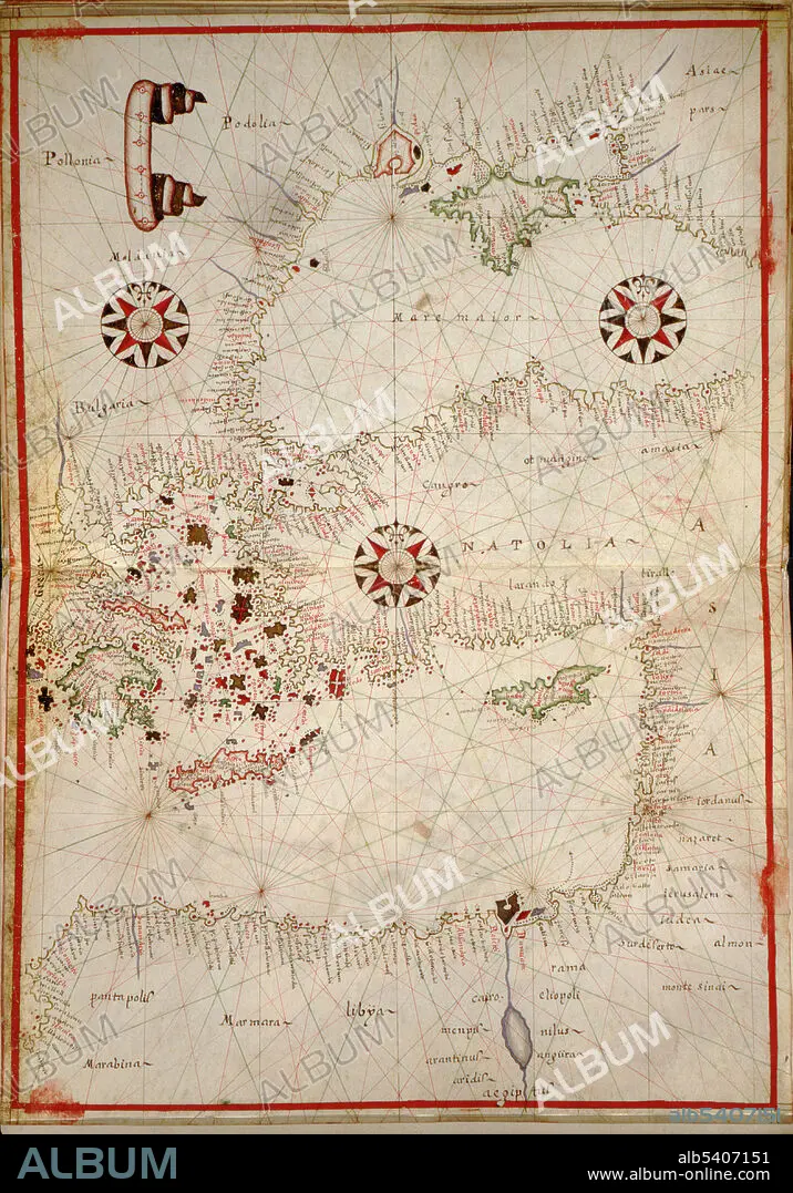
Portolan chart of the Eastern Mediterranean. Portolan charts are navigational maps based on compass directions and estimated distances observed by the pilots at sea. They were first made in the 13th century in Italy, and later in Spain and Portugal, with later 15th and 16th century charts noted for their cartographic accuracy. With the advent of widespread competition among seagoing nations during the Age of Discovery, Portugal and Spain considered such maps to be state secrets. The English and Dutch, relative newcomers, found the description of Atlantic and Indian coastlines extremely valuable for their raiding, and later trading, ships. Attributed to Joan Oliva active 1580-1615. Joan Oliva was the most prolific member of a large family of Catalan chart makers. Charts signed by at least sixteen members of the Oliva family are recorded, with dates between 1538 and 1673.
Crédito:
Album / Science Source / LOC/Geography and Map Division
Autorizaciones:
Modelo: No - Propiedad: No
¿Preguntas relacionadas con los derechos?
¿Preguntas relacionadas con los derechos?
Tamaño imagen:
3148 x 4500 px | 40.5 MB
Tamaño impresión:
26.7 x 38.1 cm | 10.5 x 15.0 in (300 dpi)
Palabras clave:
CARTA PORTULANA • CARTOGRAFIA • CATALAN • ESPANOL • FAMOSO • GEOGRAFIA • HISTORIA • MAPA • NAVEGACION • SIGLO XVI
