alb1651927
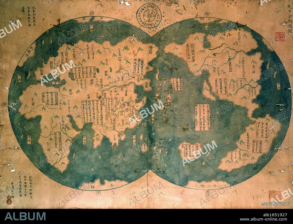
Chinese map of the world dated 1763, claiming to be a reproduction of a 1418 map of Zheng He's (1371-1433) voyages and to prove that Zheng He sailed both to Australia and the Americas. Many think the map is more likely to be based on 18th century European maps. Discovered by Lui Gang in 2005.
| Compartir |
|---|
 Pinterest Pinterest |
 Twitter Twitter |
 Facebook Facebook |
 Copiar enlace Copiar enlace |
 Email Email |
|
Añadir a otro lightbox |
|
Añadir a otro lightbox |


¿Ya tienes cuenta? Iniciar sesión
¿No tienes cuenta? Regístrate
Compra esta imagen

Descripción:
Ver traducción automática
Chinese map of the world dated 1763, claiming to be a reproduction of a 1418 map of Zheng He's (1371-1433) voyages and to prove that Zheng He sailed both to Australia and the Americas. Many think the map is more likely to be based on 18th century European maps. Discovered by Lui Gang in 2005.
Crédito:
Album / Universal Images Group / Universal History Archive
Autorizaciones:
Modelo: No - Propiedad: No
¿Preguntas relacionadas con los derechos?
¿Preguntas relacionadas con los derechos?
Tamaño imagen:
3533 x 2523 px | 25.5 MB
Tamaño impresión:
29.9 x 21.4 cm | 11.8 x 8.4 in (300 dpi)
Palabras clave:
2005 • AMERICA • AUSTRALIA • CARTOGRAFIA • CHINO • DESCUBRIMIENTO • EUROPEO • EXPLORACION • GEOGRAFIA • MAPA • MUNDO • PENSAR • RECLAMANDO • REPRODUCCION • REPRODUCTION • SIGLO XV • SIGLO XVIII • SIGLO • VARIOS
