alb3546473
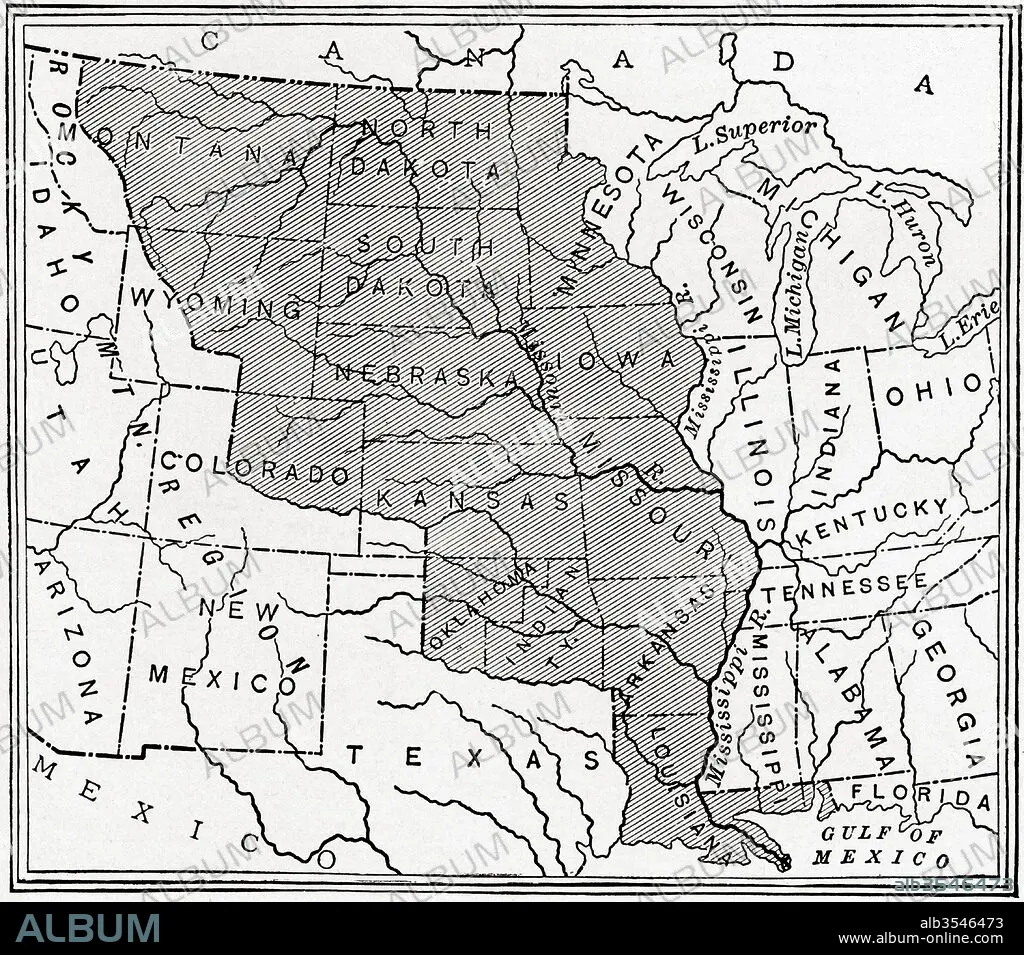
Map showing The Louisiana Purchase
| Compartir |
|---|
 Pinterest Pinterest |
 Twitter Twitter |
 Facebook Facebook |
 Copiar enlace Copiar enlace |
 Email Email |
|
Añadir a otro lightbox |
|
Añadir a otro lightbox |


¿Ya tienes cuenta? Iniciar sesión
¿No tienes cuenta? Regístrate
Compra esta imagen

Título:
Map showing The Louisiana Purchase
Descripción:
Ver traducción automática
Map showing The Louisiana Purchase. The acquisition of the Louisiana territory (828,000 square miles) by the United States from France in 1803. From The History of Our Country, published 1900
Crédito:
Album / Universal Images Group / Universal History Archive
Autorizaciones:
Modelo: No - Propiedad: No
¿Preguntas relacionadas con los derechos?
¿Preguntas relacionadas con los derechos?
Tamaño imagen:
4572 x 4026 px | 52.7 MB
Tamaño impresión:
38.7 x 34.1 cm | 15.2 x 13.4 in (300 dpi)
Palabras clave:
1803 • AMERICA • AMERICAN • AMERICANA • AMERICANO • AMERICANOS • ESTADOS UNIDOS • ESTADOUNIDENSE • ESTADOUNIDENSES • FRANCES • FRANCIA • GEOGRAFIA • GEOGRAFICO • GRAFICO • HISTORIA • HISTORICO • ILUSTRACION • LUISIANA • MAPA • MOSTRANDO • NORTEAMERICANA • NORTEAMERICANAS • NORTEAMERICANOS • SIGLO XIX • SIGLO • TERRITORIO
