alb4076076
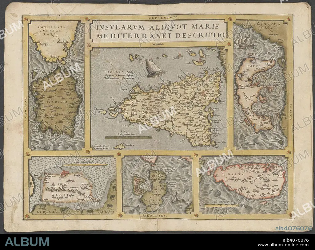
Mediterranean islands. The Mercator atlas of Europe. 1570-1572. Maps of Corsica, Sardinia, Sicily, Corfu, Elba and Malta. Image taken from The Mercator atlas of Europe. Originally published/produced in 1570-1572. . Source: Maps.C.29.c.13, 21.
| Compartir |
|---|
 Pinterest Pinterest |
 Twitter Twitter |
 Facebook Facebook |
 Copiar enlace Copiar enlace |
 Email Email |
|
Añadir a otro lightbox |
|
Añadir a otro lightbox |


¿Ya tienes cuenta? Iniciar sesión
¿No tienes cuenta? Regístrate
Compra esta imagen

Descripción:
Ver traducción automática
Mediterranean islands. The Mercator atlas of Europe. 1570-1572. Maps of Corsica, Sardinia, Sicily, Corfu, Elba and Malta. Image taken from The Mercator atlas of Europe. Originally published/produced in 1570-1572. . Source: Maps.C.29.c.13, 21.
Crédito:
Album / British Library
Autorizaciones:
Modelo: No - Propiedad: No
¿Preguntas relacionadas con los derechos?
¿Preguntas relacionadas con los derechos?
Tamaño imagen:
9589 x 7128 px | 195.6 MB
Tamaño impresión:
81.2 x 60.4 cm | 32.0 x 23.8 in (300 dpi)
Palabras clave:
CARTOGRAFIA • CORCEGA • CORFU • EUROPA OCCIDENTAL • EUROPA • ITALIA • MALTA • MAPA • MAR MEDITERRANEO • MEDITERRANEO • SICILIA • SICILY • SUR DE EUROPA • TOSCANA
