alb5584520
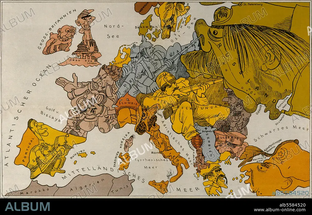
WALTER TRIER. Europe in 1914 / Satirical Map.
| Compartir |
|---|
 Pinterest Pinterest |
 Twitter Twitter |
 Facebook Facebook |
 Copiar enlace Copiar enlace |
 Email Email |
|
Añadir a otro lightbox |
|
Añadir a otro lightbox |


¿Ya tienes cuenta? Iniciar sesión
¿No tienes cuenta? Regístrate
Compra esta imagen

Autor:
Título:
Europe in 1914 / Satirical Map.
Descripción:
Ver traducción automática
First World War: Maps. - "Karte von Europa im Jahre 1914". (Map of Europe 1914.) - Map by W. Trier (1890-1951), satirizing political and military situation in Europe at the outbreak of World War I.
Técnica/material:
ARTES GRAFICAS
Localización:
Europa
Crédito:
Album / akg-images
Autorizaciones:
Modelo: No - Propiedad: No
¿Preguntas relacionadas con los derechos?
¿Preguntas relacionadas con los derechos?
Tamaño imagen:
4961 x 3147 px | 44.7 MB
Tamaño impresión:
42.0 x 26.6 cm | 16.5 x 10.5 in (300 dpi)
Palabras clave:
ALEMANIA • ART • ARTE • ARTES GRAFICAS • ARTES • CONFLICTO BELICO • CRUZ ROJA • DÉCADA DE 1910 • EUROPA • GUERRA MUNDIAL I • GUERRA • HISTORIA • MAPA • PRIMERA GUERRA MUNDIAL • SATIRA • SIGLO XX • WALTER TRIER • WAR
