alb1649833
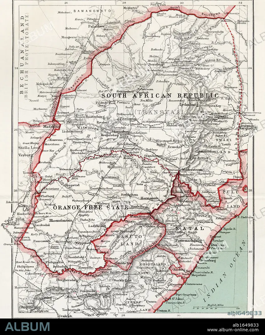
Map of South African republic, Orange Free State and Natal circa. 1900. From the book South Africa and the Transvaal War by Louis Creswicke, published 1900.
| Compartir |
|---|
 Pinterest Pinterest |
 Twitter Twitter |
 Facebook Facebook |
 Copiar enlace Copiar enlace |
 Email Email |
|
Añadir a otro lightbox |
|
Añadir a otro lightbox |


¿Ya tienes cuenta? Iniciar sesión
¿No tienes cuenta? Regístrate
Compra esta imagen

Descripción:
Ver traducción automática
Map of South African republic, Orange Free State and Natal circa. 1900. From the book South Africa and the Transvaal War by Louis Creswicke, published 1900.
Crédito:
Album / Universal History Archive/Universal Images Group
Autorizaciones:
Modelo: No - Propiedad: No
¿Preguntas relacionadas con los derechos?
¿Preguntas relacionadas con los derechos?
Tamaño imagen:
4016 x 4826 px | 55.5 MB
Tamaño impresión:
34.0 x 40.9 cm | 13.4 x 16.1 in (300 dpi)
