alb3816549
Europe Map, After Fall of Constantinople, 1453
| Compartir |
|---|
 Pinterest Pinterest |
 Twitter Twitter |
 Facebook Facebook |
 Copiar enlace Copiar enlace |
 Email Email |
|
Añadir a otro lightbox |
|
Añadir a otro lightbox |


¿Ya tienes cuenta? Iniciar sesión
¿No tienes cuenta? Regístrate
Compra esta imagen

Título:
Europe Map, After Fall of Constantinople, 1453
Descripción:
Ver traducción automática
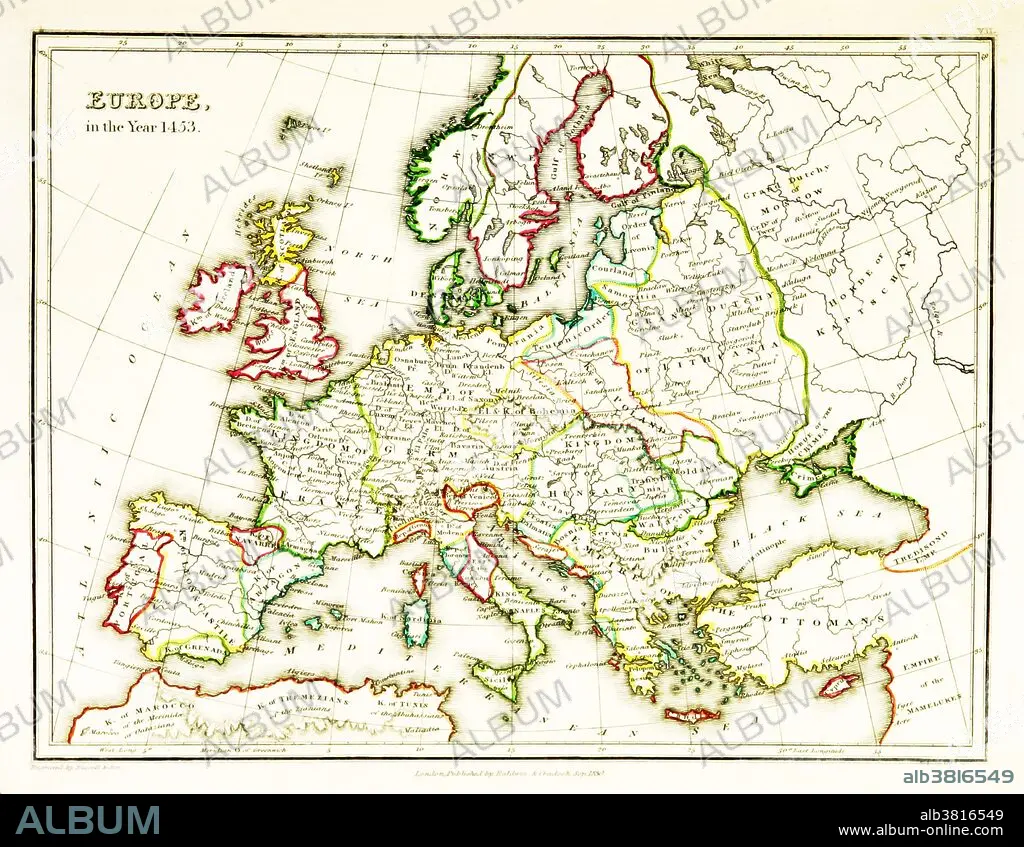
A map of Europe, showing territorial borders existing in the 15th century, specifically 1453. The Fall of Constantinople, capital of the Byzantine Empire, to the invading army of the Ottoman Empire occurred on 29 May, 1453. Map published in 1831.
Crédito:
Album / Science Source / British Library
Autorizaciones:
Modelo: No - Propiedad: No
¿Preguntas relacionadas con los derechos?
¿Preguntas relacionadas con los derechos?
Tamaño imagen:
3543 x 2746 px | 27.8 MB
Tamaño impresión:
30.0 x 23.2 cm | 11.8 x 9.2 in (300 dpi)
Palabras clave:
ANTIGUO • ARTE • CAMBIAR • DIBUJO • EUROPA • EUROPEO • FRONTERAS • HISTORIA • HISTORICO • ILUSTRACION • IMPERIO OTOMANO • IMPRESION • MAPA • OBRA DE ARTE • S. -XV • SECUENCIA • TOMA DE CONSTANTINOPLA • VINTAGE
