alb6092268
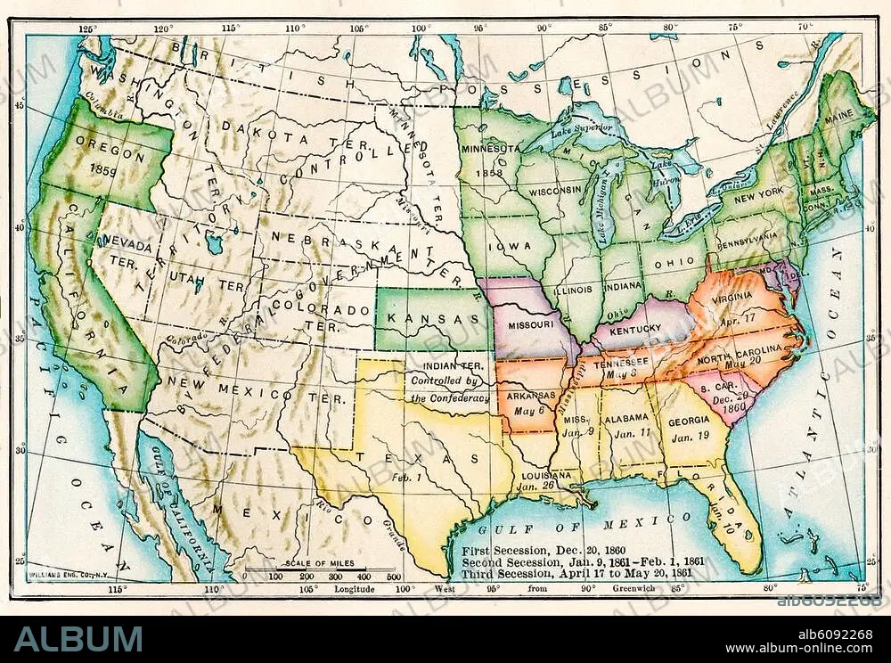
US map showing seceding states by date,
| Compartir |
|---|
 Pinterest Pinterest |
 Twitter Twitter |
 Facebook Facebook |
 Copiar enlace Copiar enlace |
 Email Email |
|
Añadir a otro lightbox |
|
Añadir a otro lightbox |


¿Ya tienes cuenta? Iniciar sesión
¿No tienes cuenta? Regístrate
Compra esta imagen

Título:
US map showing seceding states by date,
Descripción:
Ver traducción automática
US map showing seceding states by date, American Civil War, 1860 and 1861. Printed color lithograph 19th century
Crédito:
Album / akg/North Wind Picture Archives
Autorizaciones:
Modelo: No - Propiedad: No
¿Preguntas relacionadas con los derechos?
¿Preguntas relacionadas con los derechos?
Tamaño imagen:
3364 x 2326 px | 22.4 MB
Tamaño impresión:
28.5 x 19.7 cm | 11.2 x 7.8 in (300 dpi)
Palabras clave:
ART • ARTE • ARTES • CONFLICTO BELICO • EE. UU • EE. UU. • EEUU • ESTADOS UNIDOS DE AMERICA • ESTADOS UNIDOS USA EUA EEUU • ESTADOS UNIDOS • FOTOGRAFIA • GUERRA CIVIL • GUERRA • HISTORIA USA • HISTORIA • ILUSTRACION • MAPA • NORTEAMERICA • OBRA DE ARTE • SIGLO XIX • SUR • U. S. A. • USA • WAR
