alb3842680
Strait of Gibraltar, ASTER Image
| Compartir |
|---|
 Pinterest Pinterest |
 Twitter Twitter |
 Facebook Facebook |
 Copiar enlace Copiar enlace |
 Email Email |
|
Añadir a otro lightbox |
|
Añadir a otro lightbox |


¿Ya tienes cuenta? Iniciar sesión
¿No tienes cuenta? Regístrate
Compra esta imagen

Título:
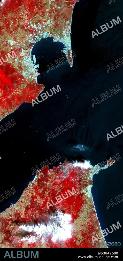
Strait of Gibraltar, ASTER Image
Descripción:
Ver traducción automática
The Strait of Gibraltar separates Spain from Morocco. This image, acquired on July 5, 2000, covers an area 21 miles wide and 37 miles long in three bands of the reflected visible and infrared wavelength region. The promontory on the eastern side of the conspicuous Spanish port is the Rock of Gibraltar. The rocky limestone and shale ridge rises abruptly from the sea, to a maximum elevation of 1,398 feet. A British colony, Gibraltar occupies a narrow strip of land at the southernmost tip of the Iberian Peninsula. It is separated from the Spanish mainland by a neutral zone contained on a narrow, sandy isthmus. Because of its strategic location and formidable topography, Gibraltar serves mainly as a British fortress. Advanced Spaceborne Thermal Emission and Reflection Radiometer (ASTER) is one of five Earth-observing instruments launched December 18, 1999, on NASA's Terra satellite.The broad spectral coverage and high spectral resolution of ASTER will provide scientists in numerous disciplines with critical information for surface mapping and monitoring dynamic conditions and temporal change.
Crédito:
Album / Science Source / NASA/GSFC/METI/ERSDAC/JAROS, and U.S./Japan ASTER Science Team
Autorizaciones:
Modelo: No - Propiedad: No
¿Preguntas relacionadas con los derechos?
¿Preguntas relacionadas con los derechos?
Tamaño imagen:
1928 x 3887 px | 21.4 MB
Tamaño impresión:
16.3 x 32.9 cm | 6.4 x 13.0 in (300 dpi)
Palabras clave:
AEREO • ASTER • ESPANA • ESPAÑA • FOTOGRAFIA AEREA • GEOGRAFIA • GEOLOGIA • MAR MEDITERRANEO • MARRUECOS • MEDITERRANEO • PENINSULA IBERICA • PENINSULA
