alb3814817
Map of Livingstone's Route Across Africa, 1857
| Compartir |
|---|
 Pinterest Pinterest |
 Twitter Twitter |
 Facebook Facebook |
 Copiar enlace Copiar enlace |
 Email Email |
|
Añadir a otro lightbox |
|
Añadir a otro lightbox |


¿Ya tienes cuenta? Iniciar sesión
¿No tienes cuenta? Regístrate
Compra esta imagen

Título:
Map of Livingstone's Route Across Africa, 1857
Descripción:
Ver traducción automática
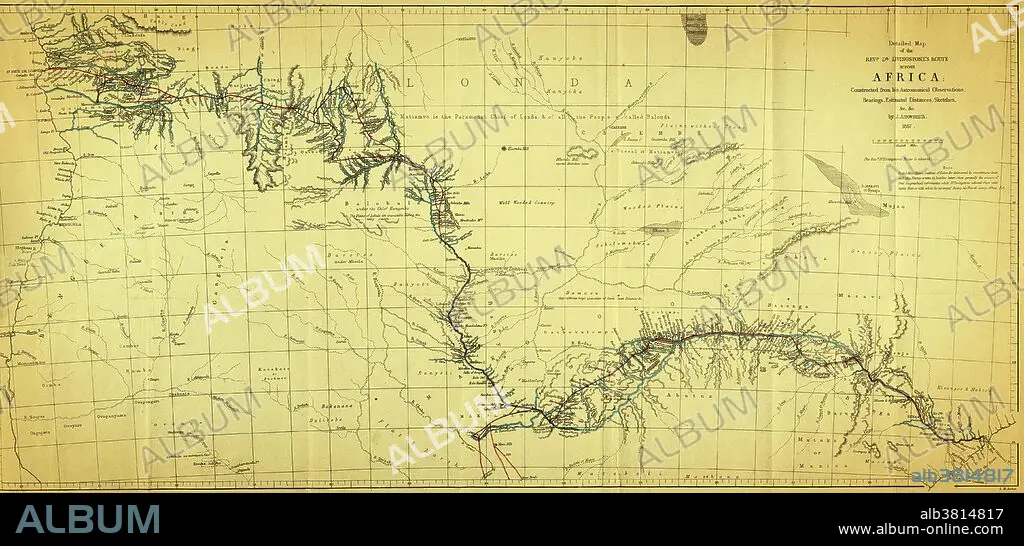
Map showing the route of David Livingstone across central Africa via the Zambesi River to the east coast, 1857. David Livingstone (1813-1873) was a Scottish explorer and medical missionary in Africa. He organized expeditions into the interior of Africa from Botswana, discovered and named Victoria Falls, and located the mouth of the Zambesi River. He mapped much of interior Africa, wrote accounts of the inhabitants, and campaigned against slavery. Along with Henry Morton Stanley, he became a celebrity in the eyes of a Victorian public captivated by their explorations. This image has been color enhanced.
Crédito:
Album / Science Source / Wellcome Images
Autorizaciones:
Modelo: No - Propiedad: No
¿Preguntas relacionadas con los derechos?
¿Preguntas relacionadas con los derechos?
Tamaño imagen:
5603 x 2700 px | 43.3 MB
Tamaño impresión:
47.4 x 22.9 cm | 18.7 x 9.0 in (300 dpi)
Palabras clave:
1800S • 1857 • AFRICA CENTRAL • AFRICA • AFRICANO • ARTE • ASIGNACIÓN • BOTSUANA • CAMINO • COLONIAL • COLONIALISMO • COLOR • COLOREADA • DIBUJO • ESCOCÉS • EXPEDICION • EXPLORACION • EXPLORAR • HISTORIA • HISTORICO • ILUSTRACION • INGLES • INTERIOR • LIVINGSTONE • MAPA • MEJORA • OBRA DE ARTE • SIGLO XIX • VIAJE
