alb3809945
Atlas of al-Idrisi
| Compartir |
|---|
 Pinterest Pinterest |
 Twitter Twitter |
 Facebook Facebook |
 Copiar enlace Copiar enlace |
 Email Email |
|
Añadir a otro lightbox |
|
Añadir a otro lightbox |


¿Ya tienes cuenta? Iniciar sesión
¿No tienes cuenta? Regístrate
Compra esta imagen

Título:
Atlas of al-Idrisi
Descripción:
Ver traducción automática
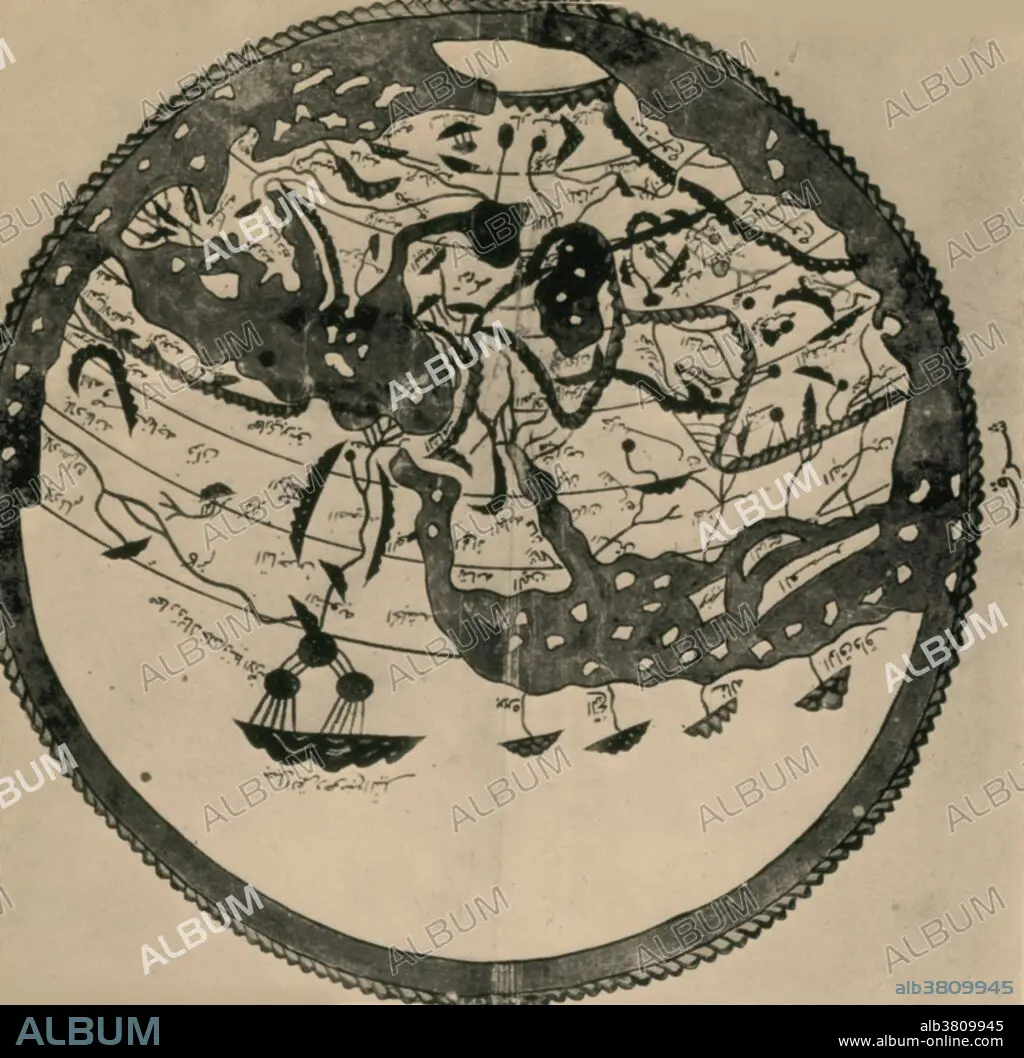
Arab geographers understood the outlines of Asia, Europe and North Africa by VI/12th century; their knowledge was summed up by the great atlas of al-Idrisi of 549/1154. It places south at the top; the map is inverted to make it easily recognizable.
Personas:
Crédito:
Album / Science Source / New York Public Library
Autorizaciones:
Modelo: No - Propiedad: No
¿Preguntas relacionadas con los derechos?
¿Preguntas relacionadas con los derechos?
Tamaño imagen:
3384 x 3321 px | 32.2 MB
Tamaño impresión:
28.7 x 28.1 cm | 11.3 x 11.1 in (300 dpi)
Palabras clave:
ARABE • ARTE • CARTOGRAFIA • COLOREADA • CONTINENTAL • CONTINENTE • CONTINENTES • DIBUJO • GEOGRAFIA • GEOGRAFICA • GRAFICO • HISTORIA • HISTORICO • ILUSTRACION • ISLÁMICO • MAPA HISTORICO • MAPA • MEJORA • OBRA DE ARTE • ORIENTE MEDIO • TARJETAS
