alb3795104
Hurricane Fran, GOES Satellite Image, 1996
| Compartir |
|---|
 Pinterest Pinterest |
 Twitter Twitter |
 Facebook Facebook |
 Copiar enlace Copiar enlace |
 Email Email |
|
Añadir a otro lightbox |
|
Añadir a otro lightbox |


¿Ya tienes cuenta? Iniciar sesión
¿No tienes cuenta? Regístrate
Compra esta imagen

Título:
Hurricane Fran, GOES Satellite Image, 1996
Descripción:
Ver traducción automática
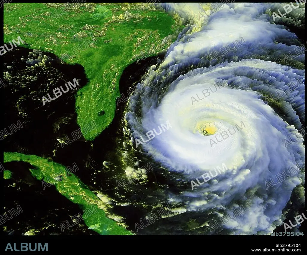
Goes 8 satellite image of Hurricane Fran. Hurricane Fran caused extensive damage in the United States in early September 1996. The sixth named storm, fifth hurricane, and fourth major hurricane of the 1996 Atlantic hurricane season, Fran developed from a tropical wave near Cape Verde on August 23. Due to nearby Hurricane Edouard, the depression remained disorganized as it tracked westward, though it eventually intensified into Tropical Storm Fran on August 27. While heading west-northwestward, Fran steadily strengthened into a hurricane on August 29, but weakened back to a tropical storm on the following day. On August 31, Fran quickly re-intensified into a hurricane. By September 2, Fran began to parallel the islands of the Bahamas and slowly curved north-northwestward. Fran peaked as a 120 mph (195 km/h) Category 3 hurricane by early on September 5. Thereafter, Fran weakened slightly, before it made landfall near Cape Fear, North Carolina early on September 6. The storm rapidly weakened inland and was only a tropical depression later that day. Eventually, Fran curved east-northeastward and transitioned into an extratropical cyclone over Ontario early on September 9.
Crédito:
Album / NASA/Science Source
Autorizaciones:
Modelo: No - Propiedad: No
¿Preguntas relacionadas con los derechos?
¿Preguntas relacionadas con los derechos?
Tamaño imagen:
4349 x 3394 px | 42.2 MB
Tamaño impresión:
36.8 x 28.7 cm | 14.5 x 11.3 in (300 dpi)
