alb4069688
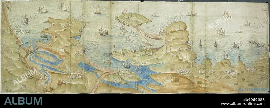
Map of Dorset coast. 1539-1540. Map of the Dorset coast from Poole to Portland and Lyme Regis, showing coastal defences, with beacons and crosses. Originally published/produced in 1539-1540. . Source: Cotton Augustus I. i. 31 and 33,.
| Compartir |
|---|
 Pinterest Pinterest |
 Twitter Twitter |
 Facebook Facebook |
 Copiar enlace Copiar enlace |
 Email Email |
|
Añadir a otro lightbox |
|
Añadir a otro lightbox |


¿Ya tienes cuenta? Iniciar sesión
¿No tienes cuenta? Regístrate
Compra esta imagen

Descripción:
Ver traducción automática
Map of Dorset coast. 1539-1540. Map of the Dorset coast from Poole to Portland and Lyme Regis, showing coastal defences, with beacons and crosses. Originally published/produced in 1539-1540. . Source: Cotton Augustus I. i. 31 and 33,.
Crédito:
Album / British Library
Autorizaciones:
Modelo: No - Propiedad: No
¿Preguntas relacionadas con los derechos?
¿Preguntas relacionadas con los derechos?
Tamaño imagen:
6932 x 2428 px | 48.2 MB
Tamaño impresión:
58.7 x 20.6 cm | 23.1 x 8.1 in (300 dpi)
Palabras clave:
CARTOGRAFIA • COSTA • EUROPA OCCIDENTAL • EUROPA • GRAN BRETAÑA • INGLATERRA • LITORAL • MAPA • ORILLA DEL MAR • TOPOGRAFIA
