alb4090842
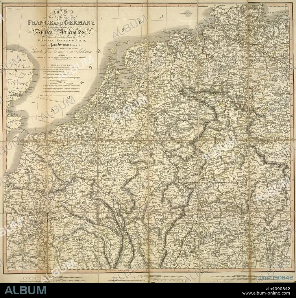
A map of the northern parts of France and Germany, including the whole of the United Netherlands. Map of the northern parts of France and Germany, including the whole of the United Netherlands, particularly distinguishing the different travelling roads...compiled from the most recent authorities. London : Published by C. Smith, Mapseller extraordinary to the Prince Regent, Nº. 172 Strand,, May 1st 1817. Source: Maps CC.5.a.207. Language: English.
| Compartir |
|---|
 Pinterest Pinterest |
 Twitter Twitter |
 Facebook Facebook |
 Copiar enlace Copiar enlace |
 Email Email |
|
Añadir a otro lightbox |
|
Añadir a otro lightbox |


¿Ya tienes cuenta? Iniciar sesión
¿No tienes cuenta? Regístrate
Compra esta imagen

Descripción:
Ver traducción automática
A map of the northern parts of France and Germany, including the whole of the United Netherlands. Map of the northern parts of France and Germany, including the whole of the United Netherlands, particularly distinguishing the different travelling roads...compiled from the most recent authorities. London : Published by C. Smith, Mapseller extraordinary to the Prince Regent, Nº. 172 Strand,, May 1st 1817. Source: Maps CC.5.a.207. Language: English.
Crédito:
Album / British Library
Autorizaciones:
Modelo: No - Propiedad: No
¿Preguntas relacionadas con los derechos?
¿Preguntas relacionadas con los derechos?
Tamaño imagen:
4890 x 4671 px | 65.3 MB
Tamaño impresión:
41.4 x 39.5 cm | 16.3 x 15.6 in (300 dpi)
Palabras clave:
ALEMANIA • CARTOGRAFIA • CARTOGRAFICO • EUROPA CENTRAL • EUROPA DEL NORTE • EUROPA OCCIDENTAL • EUROPA • FRANCES • FRANCIA • HOLANDA • MAPA • PAISES BAJOS • SIGLO XIX
