alb4080465
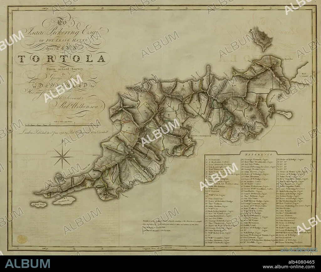
A plan of the Island of Tortola . A Plan of the Island of Tortola from actual Survey. Wilkinson, 1798. Source: Maps K.Top.123.72. Language: English.
| Compartir |
|---|
 Pinterest Pinterest |
 Twitter Twitter |
 Facebook Facebook |
 Copiar enlace Copiar enlace |
 Email Email |
|
Añadir a otro lightbox |
|
Añadir a otro lightbox |


¿Ya tienes cuenta? Iniciar sesión
¿No tienes cuenta? Regístrate
Compra esta imagen
|
?
Impresiones, tarjetas y regalos personales o referencias para artistas. Solo para un uso no comercial. No se permite la reventa.
|
$19.99 |
|
?
|
$19.99 |
|
?
|
$49.99 |
|
?
|
$69.99 |
|
?
|
$199.99 |
Añadir al carrito
Para otros usos,
Descripción:
Ver traducción automática
A plan of the Island of Tortola . A Plan of the Island of Tortola from actual Survey. Wilkinson, 1798. Source: Maps K.Top.123.72. Language: English.
Personas:
Crédito:
Album / British Library
Autorizaciones:
Modelo: No - Propiedad: No
¿Preguntas relacionadas con los derechos?
¿Preguntas relacionadas con los derechos?
Tamaño imagen:
7535 x 6012 px | 129.6 MB
Tamaño impresión:
63.8 x 50.9 cm | 25.1 x 20.0 in (300 dpi)
Palabras clave:
ARCHIPIÉLAGO • ATLANTICO • CARIBE • DOCUMENTO • ISLA • MAR CARIBE • NADIE • OCEANO ATLANTICO • PLAN • SIGLO XVIII
