alb1648613
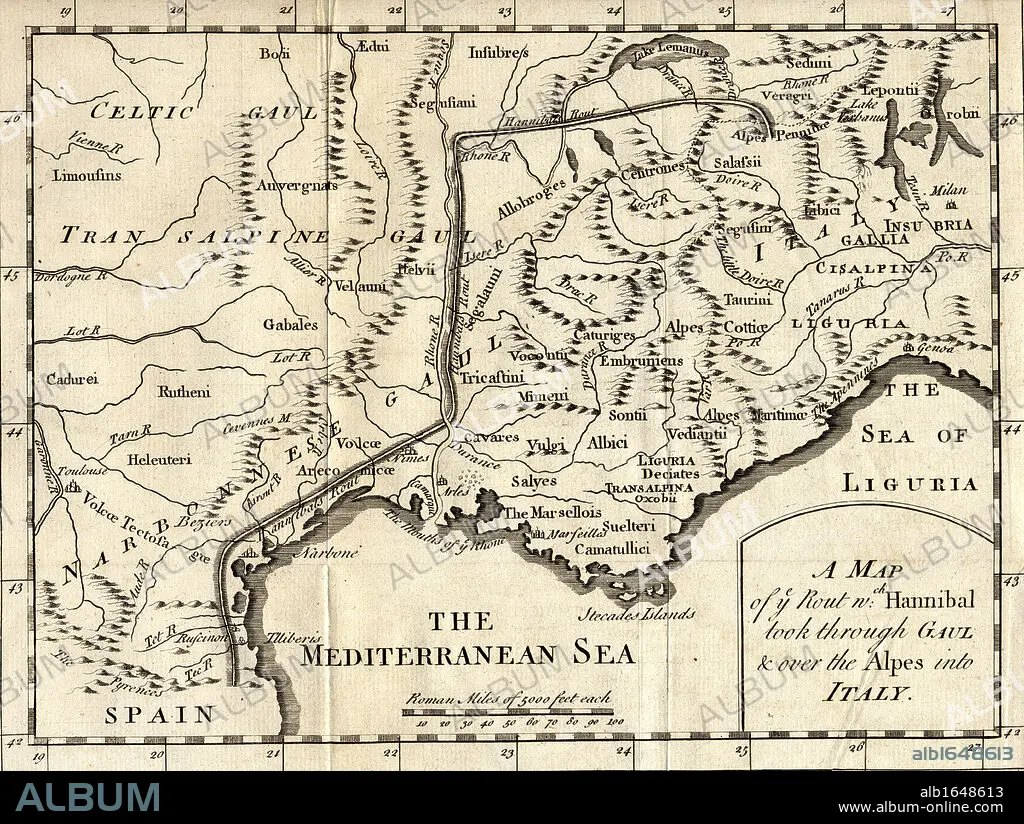
A map of the route Hannibal took through Gaul and over the Alps into Italy.
| Compartir |
|---|
 Pinterest Pinterest |
 Twitter Twitter |
 Facebook Facebook |
 Copiar enlace Copiar enlace |
 Email Email |
|
Añadir a otro lightbox |
|
Añadir a otro lightbox |


¿Ya tienes cuenta? Iniciar sesión
¿No tienes cuenta? Regístrate
Compra esta imagen

Descripción:
Ver traducción automática
A map of the route Hannibal took through Gaul and over the Alps into Italy
Crédito:
Album / Universal Images Group / Universal History Archive
Autorizaciones:
Modelo: No - Propiedad: No
¿Preguntas relacionadas con los derechos?
¿Preguntas relacionadas con los derechos?
Tamaño imagen:
5298 x 3988 px | 60.4 MB
Tamaño impresión:
44.9 x 33.8 cm | 17.7 x 13.3 in (300 dpi)
Palabras clave:
ALPES • ANÍBAL • BLANCO Y NEGRO • CARTOGRAFIA • GEOGRAFIA • HORIZONTAL • HORIZONTALES • ILUSTRACION • ITALIA • KEN • MAPA
