alb5412836
US Map, James Polk,1848
| Compartir |
|---|
 Pinterest Pinterest |
 Twitter Twitter |
 Facebook Facebook |
 Copiar enlace Copiar enlace |
 Email Email |
|
Añadir a otro lightbox |
|
Añadir a otro lightbox |


¿Ya tienes cuenta? Iniciar sesión
¿No tienes cuenta? Regístrate
Compra esta imagen

Título:
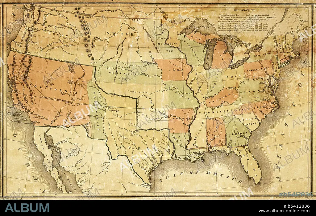
US Map, James Polk,1848
Descripción:
Ver traducción automática
This map was presented during US President James K. Polk's annual message to Congress in December 1848. It shows Polk's vision of how to divide up the new territory acquired through the Treaty of Guadalupe-Hidalgo, at the end of the Mexican-American War. Mexico ceded 55 percent of its territory, including parts of present-day Arizona, California, New Mexico, Texas, Colorado, Nevada, and Utah, to the United States.
Crédito:
Album / Science Source / National Archives
Autorizaciones:
Modelo: No - Propiedad: No
¿Preguntas relacionadas con los derechos?
¿Preguntas relacionadas con los derechos?
Tamaño imagen:
3840 x 2433 px | 26.7 MB
Tamaño impresión:
32.5 x 20.6 cm | 12.8 x 8.1 in (300 dpi)
Palabras clave:
AMERICA • CALIFORNIA • COMPROMISO DE MISSOURI • ESTADOS UNIDOS DE AMERICA • FRONTERA • HISTORIA • ILUSTRACION • MAPA • MEXICO • NEW MEXICO • NUEVO MEXICO • POLITICA • SIGLO XIX • TEXAS
