alb1961682
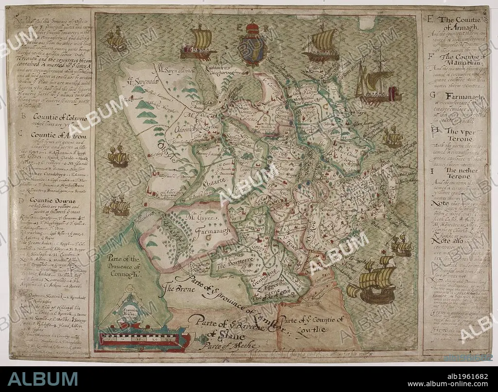
A map of Ulster with information on a plot or intrigue. Ireland. Dated about 1598. . A colored map, on vellum, of the province of Ulster. Ulster. A colored map, on vellum, of the province of Ulster, with descriptions at the sides; "Frauncis Jobsonne described this plot, and divers others, for hir Maiestie"; drawn about 1598, on a scale of 8 1/2 miles to an inch. Source: Cotton Augustus I. ii f.19.
| Compartir |
|---|
 Pinterest Pinterest |
 Twitter Twitter |
 Facebook Facebook |
 Copiar enlace Copiar enlace |
 Email Email |
|
Añadir a otro lightbox |
|
Añadir a otro lightbox |


¿Ya tienes cuenta? Iniciar sesión
¿No tienes cuenta? Regístrate
Compra esta imagen

Descripción:
Ver traducción automática
A map of Ulster with information on a plot or intrigue. Ireland. Dated about 1598. . A colored map, on vellum, of the province of Ulster. Ulster. A colored map, on vellum, of the province of Ulster, with descriptions at the sides; "Frauncis Jobsonne described this plot, and divers others, for hir Maiestie"; drawn about 1598, on a scale of 8 1/2 miles to an inch. Source: Cotton Augustus I. ii f.19.
Crédito:
Album / British Library
Autorizaciones:
Modelo: No - Propiedad: No
¿Preguntas relacionadas con los derechos?
¿Preguntas relacionadas con los derechos?
Tamaño imagen:
6516 x 4806 px | 89.6 MB
Tamaño impresión:
55.2 x 40.7 cm | 21.7 x 16.0 in (300 dpi)
Palabras clave:
CARTOGRAFIA • ESTILO Y PERIODO • EUROPA OCCIDENTAL • EUROPA • GRAN BRETAÑA • ILUSTRACION • INGLATERRA • IRLANDA • ISLAS BRITANICAS • MAPA • S. XVI • SIGLO XVI
