alb3548564
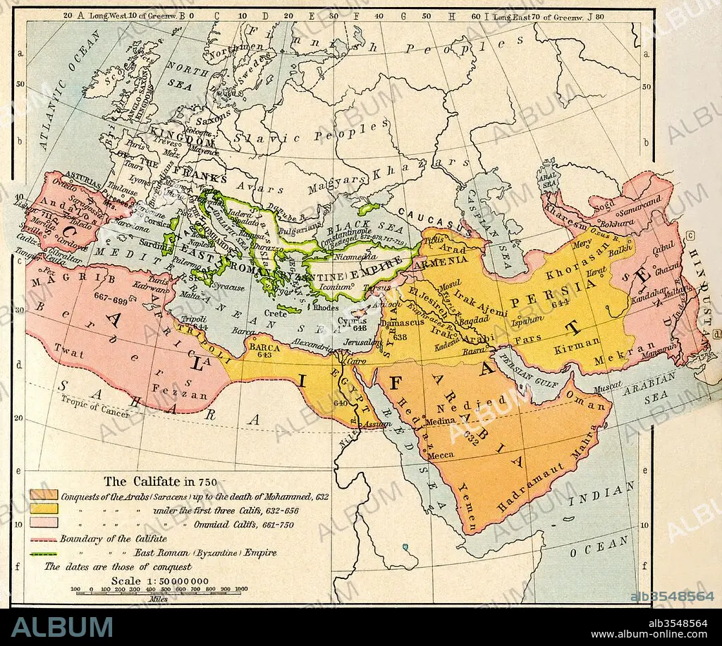
Map of the Muslim expansion and the Byzantine Empire at the end of the Umayyad Caliphate, in 750
| Compartir |
|---|
 Pinterest Pinterest |
 Twitter Twitter |
 Facebook Facebook |
 Copiar enlace Copiar enlace |
 Email Email |
|
Añadir a otro lightbox |
|
Añadir a otro lightbox |


¿Ya tienes cuenta? Iniciar sesión
¿No tienes cuenta? Regístrate
Compra esta imagen

Título:
Map of the Muslim expansion and the Byzantine Empire at the end of the Umayyad Caliphate, in 750
Descripción:
Ver traducción automática
Map of the Muslim expansion and the Byzantine Empire at the end of the Umayyad Caliphate, in 750. From Historical Atlas, published 1923.
Crédito:
Album / Universal Images Group / Universal History Archive
Autorizaciones:
Modelo: No - Propiedad: No
¿Preguntas relacionadas con los derechos?
¿Preguntas relacionadas con los derechos?
Tamaño imagen:
4724 x 3982 px | 53.8 MB
Tamaño impresión:
40.0 x 33.7 cm | 15.7 x 13.3 in (300 dpi)
